
Things to do at Santorini
Island of Santorini
ABOUT SANTORINI …
THIRA – the southernmost island of Cyclades, counts 73 km2, is 18 km long, 2-6 km wide and 568 m high.
It lost physical contact with Thirassia and Aspronisi - but still form a harmonious circle known as Thira.
It remains in strict relation with the volcanoes: Kameni, some 2 km off the western shore and the underwater Koloumbo, some 6.5 km off the eastern shore.
It is known under the names of: Thira, Stroggili, Kallisti,Santorini.
The extremely dry, yet explosive character of the island led it in the archaic past to loose more than half of its body, but did not calm it down. Successive explosions and earthquakes put
Thira now and again in new trouble and it seems that, despite of frequent winds, there is no way to extinguish its suicidal intentions.
Thus, Thira remains a cauldron (Spanish Caldera) with the Kameni islands stuck in the middle and keeping this pot boiling…
INTRODUCTION
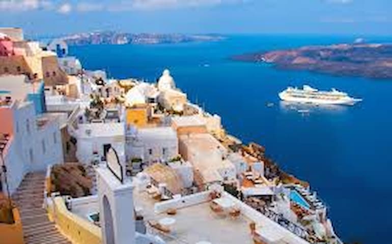
Santorini actually consists of a group of five islands which form a crescent located in the southern Aegean Sea about 200 km SE from Greece’s mainland and 128 Nautical miles of Piraeus Port.
The contrast of colors, light, earth and water makes Santorini the most treasured in the gallery of Greek islands.
Many things have been written about this unique island and many more will be written in the years to come but Santorini will always remain the crown of the Cyclades.
This is one of the most popular destinations in Greece because of its most impressive landscape. It has been said the sunsets in Santorini are the most spectacular in the world. This is Santorini
seen through the eyes of people who know and love it.
Transportation to and from Santorini is possible by ferry boats, high speed vessels and airplanes.
On the island transportation is possible by bus, car, motorbike and atv.
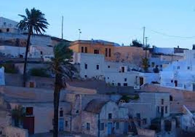
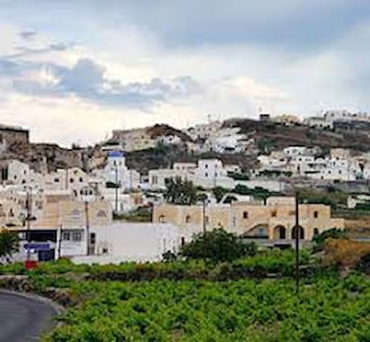
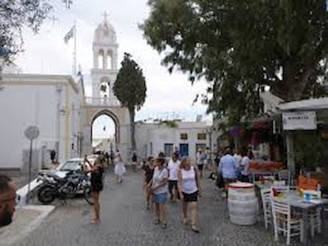
The island, with its picturesque villages, narrow alleys, traditional donkey rides, unique
architecture, local delicacies (grapes, cherry tomatoes or tomatakia, fava-beans and pistachios,
to mention some of them) and superb wines, gives the visitor a sense of fulfillment, tranquility
and refuge from the cares of the world.
89 locals recommend
Thera
ABOUT SANTORINI …
THIRA – the southernmost island of Cyclades, counts 73 km2, is 18 km long, 2-6 km wide and 568 m high.
It lost physical contact with Thirassia and Aspronisi - but still form a harmonious circle known as Thira.
It remains in strict relation with the volcanoes: Kameni, some 2 km off the western shore and the underwater Koloumbo, some 6.5 km off the eastern shore.
It is known under the names of: Thira, Stroggili, Kallisti,Santorini.
The extremely dry, yet explosive character of the island led it in the archaic past to loose more than half of its body, but did not calm it down. Successive explosions and earthquakes put
Thira now and again in new trouble and it seems that, despite of frequent winds, there is no way to extinguish its suicidal intentions.
Thus, Thira remains a cauldron (Spanish Caldera) with the Kameni islands stuck in the middle and keeping this pot boiling…
INTRODUCTION
Santorini actually consists of a group of five islands which form a crescent located in the southern Aegean Sea about 200 km SE from Greece’s mainland and 128 Nautical miles of Piraeus Port.
The contrast of colors, light, earth and water makes Santorini the most treasured in the gallery of Greek islands.
Many things have been written about this unique island and many more will be written in the years to come but Santorini will always remain the crown of the Cyclades.
This is one of the most popular destinations in Greece because of its most impressive landscape. It has been said the sunsets in Santorini are the most spectacular in the world. This is Santorini
seen through the eyes of people who know and love it.
Transportation to and from Santorini is possible by ferry boats, high speed vessels and airplanes.
On the island transportation is possible by bus, car, motorbike and atv.
The island, with its picturesque villages, narrow alleys, traditional donkey rides, unique
architecture, local delicacies (grapes, cherry tomatoes or tomatakia, fava-beans and pistachios,
to mention some of them) and superb wines, gives the visitor a sense of fulfillment, tranquility
and refuge from the cares of the world.
Villages
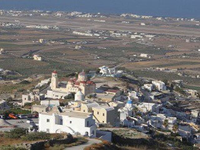
Exo Gonia is one of the few villages of Santorini that stay in contrast to the island’s busy summer life. Exo Gonia is considered the ideal village for those who wish to enjoy the silence of rustic surroundings far from the vigorous reality of the island. The village is located on a hill next to Mesa Gonia. Because of its location in historical times Exo Gonia was duly named Apano Gonia (The Corner Above). To the top of the village leads a public road that has 9 sharp bends. Crowning glory of the village is the church of Aghios Charalambos, one of the biggest churches of the island, with imposing red domes. The church of Aghios Charalambos was built in 1941 on a site of a monastery which was dissolved in 1833. The view from the top of the village allows you to admire the island from the southeast to the northeast: Prophet EIlias
and Mesa Vouno with Kamari at its foot, Monolithos with the
airport and Fira on the rim of the Caldera. On the hill to the
southwest proudly dominates above Exo Gonia the historical
village of Pyrgos.
Strolling around:
While being at the top of the village, take a walk around the
church of Aghios Charalambos. Look at the beautiful mosaic
cobbling on the courtyard. In the right corner of the courtyard, hidden among trees, there is a monument, the tribute to those islanders who fell in the world
war. Follow the stairs down to get to the ouzerie Metaxy Mas. From here you can turn left into
a narrow street. More or less half way down, on the slope you will see ruined cave houses.
On your right side (next to a garage), you will find a stairway leading down into an even more
interesting part of the village. Have a short stroll there and admire the colorful and fantastic
traditional architecture. About 40 m away there is an old church of Aghios Theologos with
beautiful, red-and-white bell-tower. Behind the church, to the right, there is one more ruined
cave house. From here you can follow the stairway up behind the church. You will reach a cobblestone street near the ouzerie Metaxy Mas. This loop will take you no more than 15
13 minutes. You can turn left behind the tavern and follow the alleyway where you will see a few neoclassical mansion
houses (so called archontika).
If you pass the turn to the church of Aghios Theologos and follow the narrow street down, you will soon get to
the main road. The small white church
on the verge of the road looks as if it was about to slide down the entire slope.
Option for tough hikers: Pass the church and go down the road until the next
curve where you will find a signpost leading to the church of Aghios Vlasios.
The trail to Aghios Vlasios initially leads in the north direction. You will see the Santorini airport from a distance.
You can also enjoy a panoramic view
of the island. With the small exception of a trash disposal area which will accompany you for a short while, the
trail passes through an uninhabited, rural
area. The church of Aghios Vlasios, a
typical island-style church, as almost of the island’s churches is closed. The trail also passes from a barn-yard. At the crossroads turn left and follow the road that will take you almost in front of Aghios Charalambos church. This walk will take you about 30 minutes but in the
hot summer days you may find it rather exhausting. However, it can be very romantic if you happen to be there during sunset…
If you wish to continue your walk along the main road, skipping the Aghios Vlasios church’s
trail, descend to an old Canava (it is hard to miss the big inscription on its gate). There is an
old cave with its front wall made of black lava stones and a narrow concrete passage next to it. If you follow it up you will get very soon to the entrance to Art Space.
Exo Gonia
Exo Gonia is one of the few villages of Santorini that stay in contrast to the island’s busy summer life. Exo Gonia is considered the ideal village for those who wish to enjoy the silence of rustic surroundings far from the vigorous reality of the island. The village is located on a hill next to Mesa Gonia. Because of its location in historical times Exo Gonia was duly named Apano Gonia (The Corner Above). To the top of the village leads a public road that has 9 sharp bends. Crowning glory of the village is the church of Aghios Charalambos, one of the biggest churches of the island, with imposing red domes. The church of Aghios Charalambos was built in 1941 on a site of a monastery which was dissolved in 1833. The view from the top of the village allows you to admire the island from the southeast to the northeast: Prophet EIlias
and Mesa Vouno with Kamari at its foot, Monolithos with the
airport and Fira on the rim of the Caldera. On the hill to the
southwest proudly dominates above Exo Gonia the historical
village of Pyrgos.
Strolling around:
While being at the top of the village, take a walk around the
church of Aghios Charalambos. Look at the beautiful mosaic
cobbling on the courtyard. In the right corner of the courtyard, hidden among trees, there is a monument, the tribute to those islanders who fell in the world
war. Follow the stairs down to get to the ouzerie Metaxy Mas. From here you can turn left into
a narrow street. More or less half way down, on the slope you will see ruined cave houses.
On your right side (next to a garage), you will find a stairway leading down into an even more
interesting part of the village. Have a short stroll there and admire the colorful and fantastic
traditional architecture. About 40 m away there is an old church of Aghios Theologos with
beautiful, red-and-white bell-tower. Behind the church, to the right, there is one more ruined
cave house. From here you can follow the stairway up behind the church. You will reach a cobblestone street near the ouzerie Metaxy Mas. This loop will take you no more than 15
13 minutes. You can turn left behind the tavern and follow the alleyway where you will see a few neoclassical mansion
houses (so called archontika).
If you pass the turn to the church of Aghios Theologos and follow the narrow street down, you will soon get to
the main road. The small white church
on the verge of the road looks as if it was about to slide down the entire slope.
Option for tough hikers: Pass the church and go down the road until the next
curve where you will find a signpost leading to the church of Aghios Vlasios.
The trail to Aghios Vlasios initially leads in the north direction. You will see the Santorini airport from a distance.
You can also enjoy a panoramic view
of the island. With the small exception of a trash disposal area which will accompany you for a short while, the
trail passes through an uninhabited, rural
area. The church of Aghios Vlasios, a
typical island-style church, as almost of the island’s churches is closed. The trail also passes from a barn-yard. At the crossroads turn left and follow the road that will take you almost in front of Aghios Charalambos church. This walk will take you about 30 minutes but in the
hot summer days you may find it rather exhausting. However, it can be very romantic if you happen to be there during sunset…
If you wish to continue your walk along the main road, skipping the Aghios Vlasios church’s
trail, descend to an old Canava (it is hard to miss the big inscription on its gate). There is an
old cave with its front wall made of black lava stones and a narrow concrete passage next to it. If you follow it up you will get very soon to the entrance to Art Space.
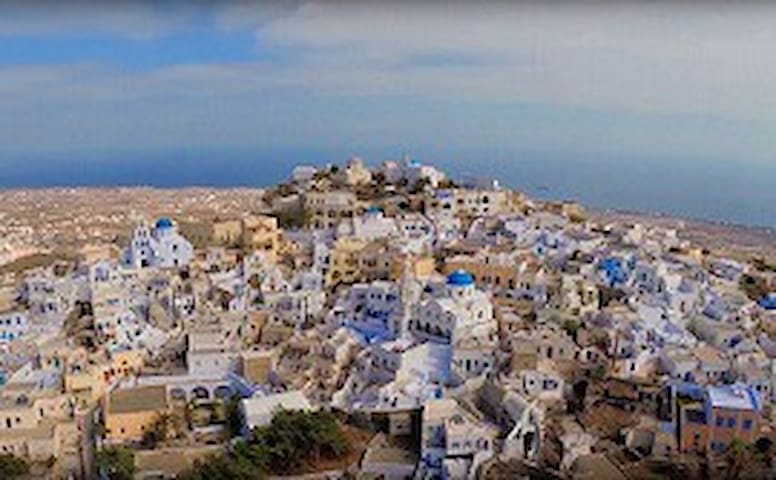
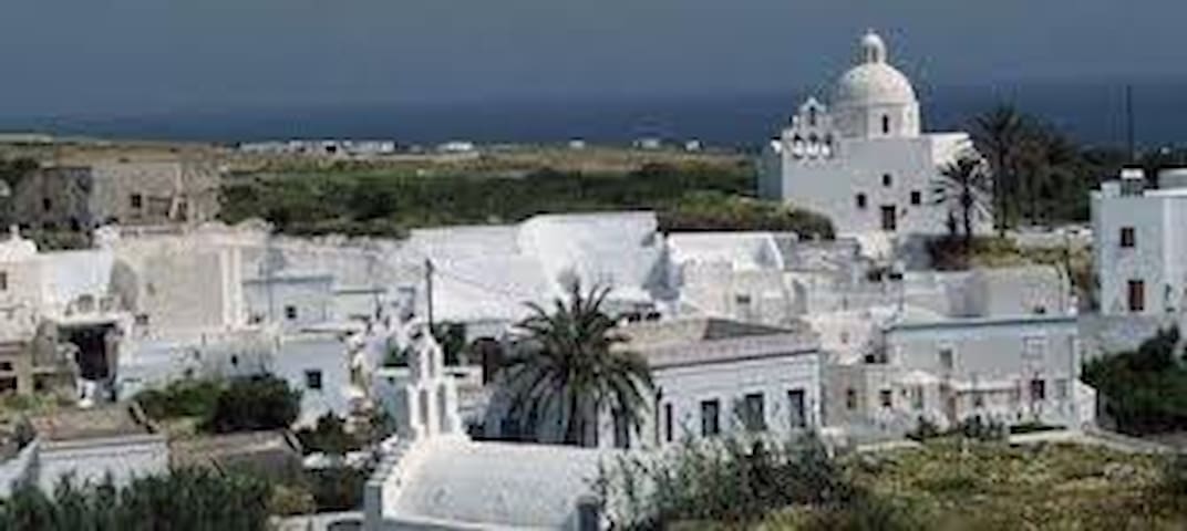
Picturesquely located on a round hill, some 360 m above the sea level. After the collapse of the medieval capital on Skaros, Pyrgos became the temporary capital of the island until 1800.
Pyrgos has a long history; it is believed to be one of the 6 settlements of Ancient Thira.
During the Middle Ages, mainly during Latin rule up to the 16th century the island suffered
a lot from pirate raids. The locals had to fortify their settlements. This is how the kastelia
appeared on the island. Kastelia were built also in Skaros, Oia, Emporio and Akrotiri.
The oldest known documentation about Kasteli of Pyrgos is dated back to the 16th century. Kastelia
were built in strategic positions, highest and most inaccessible parts of the island so that
they were easy to defense and to survey the neighborhood. Because of limited space, sloping
ground and their defensive character, the houses within kastelia were densely packed, literally
stuck one by another. The outermost houses were also the outer walls of the fortification.
The streets of kasteli (rymidia) were narrow and irregular, forming a labyrinth-like net. The fortified entrance to Kasteli of Pyrgos was on its western side and its defensive character was strengthened by constructions with pots for hot oil which was spilt on enemies.
The entrance to the kasteli is called Xeporta – the Outside Door.
At times of Turkish domination on the island (1537-1821) pirate raids ceased gradually and
the locals started to build their houses outside the kastelia. The new districts of once fortified
settlements were growing dynamically, becoming continuation of maize-like character of
kasteli…
Kasteli of Pyrgos suffered severe damages during the 1956 earthquake.
Until the earthquake, narrow alleyways of Kasteli were covered with plakoto (stone pavement). Later they had been
covered with concrete to smooth the breakages and to cover telephone wiring.
In some places, especially on the sides of footways you can spot fragments of original plakoto.
Contemporary Pyrgos is a vast, lively settlement covering the hill all around, far beyond the boundaries of Kasteli. It
has more than 650 permanent residents.
It also prides itself of having the highest 16
location of all villages on Santorini. In Pyrgos you will find more than 40 churches. As almost all churches on Santorini, they are opened only at special occasions like celebration of the patron. That particular day wine and traditional food prepared by local housekeepers is served in the church and everybody is welcome to join the feast (panigiri).
Ironically, despite the fairly high number of churches adorning Pyrgos with their white and
blue domes and sophisticated bell-towers, the regular holy mass takes place in the small Agios
Antonios some 100 m behind the square, far down the hill.
Strolling around:
-Pyrgos village:
From the small square (Emmanouil Sorotou) follow the
main road into the town to the main square (Stefanou Melekou).
Start your stroll from paying a visit to the exhibition “The Vanishing Santorini” which you will find some 80 m down
the square. The museum is located in old kanava. A short visit there will give you a picture of the past everyday life of the islanders.
In order to get to Kasteli follow the steps behind the post box at the Melekou square. On your
way up you will have opportunity to buy local products and wine. For your convenience it is
advisable to postpone the shopping until the return from kasteli. From here the best way to get
up is following the blue arrows painted on the streets
The first big church on your way is church of Christ. This church celebrates its panigiri on August 6th, only 9 days before the celebration of the most important church in Pyrgos – the so called Theotokaki (Church of Virgin Mary).
For this reason meals served on August 6 do not contain meat. Meat, which is scarce on Santorini, is preserved for
the big feast in Theotokaki that will take place a few days later.
The arched gate to kasteli (Xeporta - Outside door) is above a square called Exoplateia. Once, noblemen of the
settlement gathered around here to vote. Have a look at the church of Aghios Nikolaos with a bell-tower that
is said to be one of the most beautiful on this island. In front of the church stands a monument commemorating those islanders who died during the World War. On the opposite side you will see a neoclassic mansion with
beautiful ornaments. There are more mansions like this around the kasteli. They usually are
distinguished from the surroundings not only by their size and sophisticated architecture, but
also vivid colors. These houses are an architectonic work-of-art that could be afforded only by the landlords. They appeared on the island during the more peaceful
times, after pirate attacks finally ceased. Behind the mansion is the church of Aghia Theodosia. If you wish to do something more extravagant, have a picture taken on
a donkey in the square…
After entering the kasteli, take a right turn. Just behind the corner is one of the biggest churches on
Santorini – Eisodion tis Theotokou (Presenatation of Saint Mary) dated from 17th century. In the neighborhood is the ochre-painted church of Aghia Triada, formerly
catholic, now it is housing a collection of liturgical objects and icons, the oldest of which is dated
to 16th century. The museum is operating from March to October and entrance is free of
charge. You are actually at the top of the Kasteli. Behind the Aghia Triada is a narrow passage
to the small, white-washed Theotokaki. It is dated from 10th century and is one of the oldest churches on this island. The view of the island from here is gorgeous and will repay you all
your efforts which you put to get there.
Hint: The Kasteli is criss-crossed by countless narrow streets and stairways running in all
possible directions but even if you have the impression of being lost, do not worry, the blue arrows will appear mercifully under your feet at the most unexpected moment…
From the Stefanou Melekou square you can follow the plakoto that runs to the east. Soon you will get onto a small parking area near a school. There are three streets going out from there. The left one will take you back to the main square, the middle one leads to Kasteli. The
right one is not paved and leads along the north-eastern walls of Kasteli. This is an option for tough hikers. The walk takes about 20 minutes and gives you opportunity to enjoy panoramic views of the island. On the foot of the
mountain of Profitis Ilias is a quarry of pumice stone (SE). Then, in a valley you can spot big, grey edifice of the church of Saint Nicolas dated from the18th century,
lost among terraced fields. Like Episkopi Gonias, this church was raised with use of marble elements from Ancient Thira.
Following the path still to the east you will easily find the red domes of the church of Aghios Charalambos on the very top of Exo Gonia, and finally the long grey line of the airport. Your way now will turn left; up the rock is the white church of
Aghios Christoforos. Climb up the stairs, pass next to the church and continue your walk. Continue the walk until you get back to the Church of Aghia Theodosia at the NW side of the Kasteli. From here you have only 5 minutes
to the square of Stefanou Melekou.
Well done! It is time to have a rest.
23 locals recommend
Pyrgos
Picturesquely located on a round hill, some 360 m above the sea level. After the collapse of the medieval capital on Skaros, Pyrgos became the temporary capital of the island until 1800.
Pyrgos has a long history; it is believed to be one of the 6 settlements of Ancient Thira.
During the Middle Ages, mainly during Latin rule up to the 16th century the island suffered
a lot from pirate raids. The locals had to fortify their settlements. This is how the kastelia
appeared on the island. Kastelia were built also in Skaros, Oia, Emporio and Akrotiri.
The oldest known documentation about Kasteli of Pyrgos is dated back to the 16th century. Kastelia
were built in strategic positions, highest and most inaccessible parts of the island so that
they were easy to defense and to survey the neighborhood. Because of limited space, sloping
ground and their defensive character, the houses within kastelia were densely packed, literally
stuck one by another. The outermost houses were also the outer walls of the fortification.
The streets of kasteli (rymidia) were narrow and irregular, forming a labyrinth-like net. The fortified entrance to Kasteli of Pyrgos was on its western side and its defensive character was strengthened by constructions with pots for hot oil which was spilt on enemies.
The entrance to the kasteli is called Xeporta – the Outside Door.
At times of Turkish domination on the island (1537-1821) pirate raids ceased gradually and
the locals started to build their houses outside the kastelia. The new districts of once fortified
settlements were growing dynamically, becoming continuation of maize-like character of
kasteli…
Kasteli of Pyrgos suffered severe damages during the 1956 earthquake.
Until the earthquake, narrow alleyways of Kasteli were covered with plakoto (stone pavement). Later they had been
covered with concrete to smooth the breakages and to cover telephone wiring.
In some places, especially on the sides of footways you can spot fragments of original plakoto.
Contemporary Pyrgos is a vast, lively settlement covering the hill all around, far beyond the boundaries of Kasteli. It
has more than 650 permanent residents.
It also prides itself of having the highest 16
location of all villages on Santorini. In Pyrgos you will find more than 40 churches. As almost all churches on Santorini, they are opened only at special occasions like celebration of the patron. That particular day wine and traditional food prepared by local housekeepers is served in the church and everybody is welcome to join the feast (panigiri).
Ironically, despite the fairly high number of churches adorning Pyrgos with their white and
blue domes and sophisticated bell-towers, the regular holy mass takes place in the small Agios
Antonios some 100 m behind the square, far down the hill.
Strolling around:
-Pyrgos village:
From the small square (Emmanouil Sorotou) follow the
main road into the town to the main square (Stefanou Melekou).
Start your stroll from paying a visit to the exhibition “The Vanishing Santorini” which you will find some 80 m down
the square. The museum is located in old kanava. A short visit there will give you a picture of the past everyday life of the islanders.
In order to get to Kasteli follow the steps behind the post box at the Melekou square. On your
way up you will have opportunity to buy local products and wine. For your convenience it is
advisable to postpone the shopping until the return from kasteli. From here the best way to get
up is following the blue arrows painted on the streets
The first big church on your way is church of Christ. This church celebrates its panigiri on August 6th, only 9 days before the celebration of the most important church in Pyrgos – the so called Theotokaki (Church of Virgin Mary).
For this reason meals served on August 6 do not contain meat. Meat, which is scarce on Santorini, is preserved for
the big feast in Theotokaki that will take place a few days later.
The arched gate to kasteli (Xeporta - Outside door) is above a square called Exoplateia. Once, noblemen of the
settlement gathered around here to vote. Have a look at the church of Aghios Nikolaos with a bell-tower that
is said to be one of the most beautiful on this island. In front of the church stands a monument commemorating those islanders who died during the World War. On the opposite side you will see a neoclassic mansion with
beautiful ornaments. There are more mansions like this around the kasteli. They usually are
distinguished from the surroundings not only by their size and sophisticated architecture, but
also vivid colors. These houses are an architectonic work-of-art that could be afforded only by the landlords. They appeared on the island during the more peaceful
times, after pirate attacks finally ceased. Behind the mansion is the church of Aghia Theodosia. If you wish to do something more extravagant, have a picture taken on
a donkey in the square…
After entering the kasteli, take a right turn. Just behind the corner is one of the biggest churches on
Santorini – Eisodion tis Theotokou (Presenatation of Saint Mary) dated from 17th century. In the neighborhood is the ochre-painted church of Aghia Triada, formerly
catholic, now it is housing a collection of liturgical objects and icons, the oldest of which is dated
to 16th century. The museum is operating from March to October and entrance is free of
charge. You are actually at the top of the Kasteli. Behind the Aghia Triada is a narrow passage
to the small, white-washed Theotokaki. It is dated from 10th century and is one of the oldest churches on this island. The view of the island from here is gorgeous and will repay you all
your efforts which you put to get there.
Hint: The Kasteli is criss-crossed by countless narrow streets and stairways running in all
possible directions but even if you have the impression of being lost, do not worry, the blue arrows will appear mercifully under your feet at the most unexpected moment…
From the Stefanou Melekou square you can follow the plakoto that runs to the east. Soon you will get onto a small parking area near a school. There are three streets going out from there. The left one will take you back to the main square, the middle one leads to Kasteli. The
right one is not paved and leads along the north-eastern walls of Kasteli. This is an option for tough hikers. The walk takes about 20 minutes and gives you opportunity to enjoy panoramic views of the island. On the foot of the
mountain of Profitis Ilias is a quarry of pumice stone (SE). Then, in a valley you can spot big, grey edifice of the church of Saint Nicolas dated from the18th century,
lost among terraced fields. Like Episkopi Gonias, this church was raised with use of marble elements from Ancient Thira.
Following the path still to the east you will easily find the red domes of the church of Aghios Charalambos on the very top of Exo Gonia, and finally the long grey line of the airport. Your way now will turn left; up the rock is the white church of
Aghios Christoforos. Climb up the stairs, pass next to the church and continue your walk. Continue the walk until you get back to the Church of Aghia Theodosia at the NW side of the Kasteli. From here you have only 5 minutes
to the square of Stefanou Melekou.
Well done! It is time to have a rest.
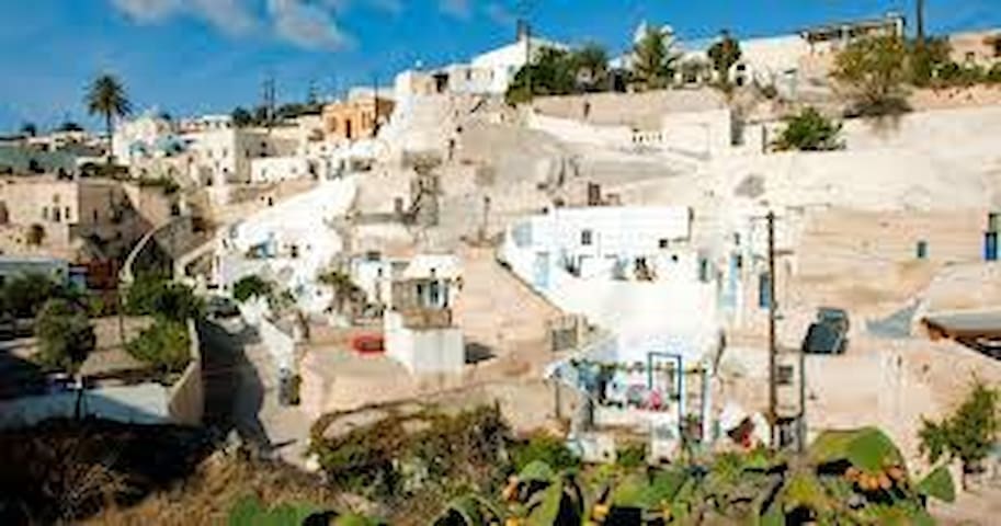
Vothonas is another example of a “river-bed” settlement. The village is located in a 5 km long galley. The settlement, which history goes back to the 18th century, does not extend that far though. Vothonas, as other villages of this type, is densely built due to limited width of the
ravine. To gain more space the majority of dwellings are carved in the soft tephra (mix of pumice and volcanic ash). Because of their simplicity these cave houses (so called hyposkafa) have been very popular on Santorini, especially among farmers, who were not well-off.
Now they belong to the most expensive dwellings on this island.
Hyposkafa are quite narrow, but long. The front wall has door and windows on both sides of it. Most of the cave houses have one main room just behind the door and a smaller one
(bedchamber) on the back. The wall sharing the two rooms has also openings analogous to the front wall. The roofing is vaulted. A small kitchen is adjacent to the main room. Restroom is outside in the courtyard, where also the cistern for collecting rainwater is located. Water was always scarce on Santorini and therefore rain was the main source of sweet water on the island.
Hyposkafa, due to their vaulted roofing and flexible construction material have anti-seismic properties. Even more, porous pumice is a good isolating material, therefore ensures relatively stable temperatures inside the house. Last but not least, the only element connecting the house
with the outside world was a narrow front wall, so that the dwelling was hard to find by pirates.
While landlords had their kastelia, farmers had their own barricades within hyposkafa.
Many houses on Santorini are half-built – they are carved in the rock, but their façade is not limited to the front wall, but is built, to make the construction more spacious. It is not difficult to spot both types of constructions in Vothonas.
Strolling around:
The northern descent to the village is by a stairway from the publicroad, next to the public school.
From this stairway you have a short walk to the yellow-colored church of Aghia Anna (left turn before an arch), or you can continue straight forward (pass through the arch),
along street Ilia Anaplioti. This street runs along the galley. On both its sides you will see rocky walls, literally perforated with numerous cave houses, so that hardly a piece of untouched rock can be seen. After some 5 minutes of walking you will get to the end of the inhabited area where more hyposkafa can bee seen. Some of them are abandoned and the surroundings gradually become wilder and greener. For next 60 m the way is dominated by wild nature, so that you will never get tired with this walk. It will take you to a church of Aghios Prokopios, which is carved in the rock.
There is also another church carved in the rock, which Vothonas is famous for. This one is called Panagia Sergena, or more popularly – Panagia tis Trypas.
If you return from Aghios Prokopios, just by the first opportunity turn left and go to the west. From the northern
entrance, take a right turn before the arch and then take another right turn to the west, so that soon you will pass next to the salmon-colored church of Aghia Triada. Just below is
one more church in a cave. Proceed to the west. Both streets finally will lead you to the big church of Panagia (faded salmon color). Have a look at the fascinating front walls
of the cave houses around there. Then proceed along the street SW, along the galley. There are roughly 300 m to go. The inhabited area ends here. The street leads now among mostly abandoned caves. A whitewashed church high up on the slope can make your heart beats faster,
but this is not your final destination. Anyways, you can climb up the 85 steps leading to the
church of Aghios Georgios, because the view from above is fascinating! If you are visiting Vothonas shortly before sunset you will see far away in the gorge the village sparkling white and orange in the evening sun. From Aghios Georgios the way becomes less comfortable; it soon turns into a narrow trail laid with small pumice stones. For this reason it is good to plan this walk some time sooner and take athletic shoes with you. Flip-flops may spoil all the attraction… The church
of Panagia tis Trypas (Virgin Mary in the Hole) was a
shelter for the locals during pirate invasions. The church was dug in the rock 20 m above the ground, once the entrance to
it was by a ladder, which was pulled up after the people climbed it.
Return to the village the same way as you came here. To find the exit from the village go towards Aghia Triada, turn left after getting to the church courtyard and follow the passage
about 50 m more. You will be at the southern end of the village.
While being in Vothonas it is recommended to extend your walk to the winery of Koutsogiannopoulous. The winery is about 1.5 km east from the center of the settlement,
by the road Kamari-Messaria. The easiest way to get there is to follow the street leading to Aghios Prokopios, pass the church and continue until you get to the public road. Turn left and the winery is on right side of the road. You can have a tour to the underground museum of the winery that presents the history of viticulture in a very specific and amusing way. The figures, movable and immovable are the second-to-none attraction of the exhibition. The winery is
open for visits everyday from 10:00 to 20:00, the ticket allows you to both visit the museum (with an electronic guide) and to taste Santorini wines.
7 locals recommend
Vothonas
Vothonas is another example of a “river-bed” settlement. The village is located in a 5 km long galley. The settlement, which history goes back to the 18th century, does not extend that far though. Vothonas, as other villages of this type, is densely built due to limited width of the
ravine. To gain more space the majority of dwellings are carved in the soft tephra (mix of pumice and volcanic ash). Because of their simplicity these cave houses (so called hyposkafa) have been very popular on Santorini, especially among farmers, who were not well-off.
Now they belong to the most expensive dwellings on this island.
Hyposkafa are quite narrow, but long. The front wall has door and windows on both sides of it. Most of the cave houses have one main room just behind the door and a smaller one
(bedchamber) on the back. The wall sharing the two rooms has also openings analogous to the front wall. The roofing is vaulted. A small kitchen is adjacent to the main room. Restroom is outside in the courtyard, where also the cistern for collecting rainwater is located. Water was always scarce on Santorini and therefore rain was the main source of sweet water on the island.
Hyposkafa, due to their vaulted roofing and flexible construction material have anti-seismic properties. Even more, porous pumice is a good isolating material, therefore ensures relatively stable temperatures inside the house. Last but not least, the only element connecting the house
with the outside world was a narrow front wall, so that the dwelling was hard to find by pirates.
While landlords had their kastelia, farmers had their own barricades within hyposkafa.
Many houses on Santorini are half-built – they are carved in the rock, but their façade is not limited to the front wall, but is built, to make the construction more spacious. It is not difficult to spot both types of constructions in Vothonas.
Strolling around:
The northern descent to the village is by a stairway from the publicroad, next to the public school.
From this stairway you have a short walk to the yellow-colored church of Aghia Anna (left turn before an arch), or you can continue straight forward (pass through the arch),
along street Ilia Anaplioti. This street runs along the galley. On both its sides you will see rocky walls, literally perforated with numerous cave houses, so that hardly a piece of untouched rock can be seen. After some 5 minutes of walking you will get to the end of the inhabited area where more hyposkafa can bee seen. Some of them are abandoned and the surroundings gradually become wilder and greener. For next 60 m the way is dominated by wild nature, so that you will never get tired with this walk. It will take you to a church of Aghios Prokopios, which is carved in the rock.
There is also another church carved in the rock, which Vothonas is famous for. This one is called Panagia Sergena, or more popularly – Panagia tis Trypas.
If you return from Aghios Prokopios, just by the first opportunity turn left and go to the west. From the northern
entrance, take a right turn before the arch and then take another right turn to the west, so that soon you will pass next to the salmon-colored church of Aghia Triada. Just below is
one more church in a cave. Proceed to the west. Both streets finally will lead you to the big church of Panagia (faded salmon color). Have a look at the fascinating front walls
of the cave houses around there. Then proceed along the street SW, along the galley. There are roughly 300 m to go. The inhabited area ends here. The street leads now among mostly abandoned caves. A whitewashed church high up on the slope can make your heart beats faster,
but this is not your final destination. Anyways, you can climb up the 85 steps leading to the
church of Aghios Georgios, because the view from above is fascinating! If you are visiting Vothonas shortly before sunset you will see far away in the gorge the village sparkling white and orange in the evening sun. From Aghios Georgios the way becomes less comfortable; it soon turns into a narrow trail laid with small pumice stones. For this reason it is good to plan this walk some time sooner and take athletic shoes with you. Flip-flops may spoil all the attraction… The church
of Panagia tis Trypas (Virgin Mary in the Hole) was a
shelter for the locals during pirate invasions. The church was dug in the rock 20 m above the ground, once the entrance to
it was by a ladder, which was pulled up after the people climbed it.
Return to the village the same way as you came here. To find the exit from the village go towards Aghia Triada, turn left after getting to the church courtyard and follow the passage
about 50 m more. You will be at the southern end of the village.
While being in Vothonas it is recommended to extend your walk to the winery of Koutsogiannopoulous. The winery is about 1.5 km east from the center of the settlement,
by the road Kamari-Messaria. The easiest way to get there is to follow the street leading to Aghios Prokopios, pass the church and continue until you get to the public road. Turn left and the winery is on right side of the road. You can have a tour to the underground museum of the winery that presents the history of viticulture in a very specific and amusing way. The figures, movable and immovable are the second-to-none attraction of the exhibition. The winery is
open for visits everyday from 10:00 to 20:00, the ticket allows you to both visit the museum (with an electronic guide) and to taste Santorini wines.
One more example of settlements located in the gorge.
For this reason the central part of the settlement is built up
with traditional farm houses and mansions while on its rocky sides you encounter numerous cave houses. Existence of Messaria is mentioned in historical reports dated to the 17th century. The name of the village refers to its geographical location: in the middle of the island (Greek: mesa = in the middle). Once (19th and early 20th century)
Messaria was the industrial center of the island. Here operated the big Markezini knitting factory and Venetzanos Winery.
Contemporary Messaria is a lively village and centre of wine production, surrounded with vineyards.
Walking along the streets in Messaria does not require a long time, the village with its more or less 700 inhabitants is rather small and its size is naturally limited by the ravine in which is
located. It is devoid of the harmony and beauty of Karterados, Finikia or Vothonas. The streets have a rather hard-up character and constantly barking dogs will convince you that you are nothing more than an intruder. Despite this, Messaria has some highlights that will catch your
eye, and for this reason it is worth to devote some time for a visit.
Strolling around:
You start your visit in vicinity of the imposing, ruined mansion of family Saliveros. Just behind this is old winery of Venetsanos (with the long chimney). You can walk along the
narrow Danezi street where most of the houses here are contemporary structures, by the end
though, near a church, there are some abandoned cave houses.
A more interesting route you can take if you turn right from Argyroy street and pass next to the school. Go towards an outstanding, colorful Argyros Mansion. This 19th century eclectic building suffered serious damages after the earthquake, but was restored and currently is open
for visits. Guided tours are run from May to October. Turn left behind the mansion and climb up the stairs to the courtyard of the church of Aghios Dimitris. It was built late in the 19th
century. Adjacent to it is the white-domed church of Christ. On the left side you will encounter ruins of the Markenzini knitting factory set up in 1889.
Return to the Argyros Mansion and go north so that you go under an arch and turn left to get next
to the church of Christ. Follow the passage, on your right side you will soon see the church of Aghia Barbara, and next – the big church of Aghia Irini with its fancy bell-tower. A few steps behind the church there are ruined cave houses. Continue up the street. It is about 100 m long. At its end, which is actually the exit from the densely built up village,
on the left side of the street stays a ruined windmill. From here the best thing to do is to return the
same way you have come. Behind the church of Christ turn left. This street runs parallel to the previous one, but in the proximity of the slope so that you can see numerous hyposkafa dug in its walls. The nearest church on this way is raised just by the rocky wall. The first example,
really worth seeing, are cave houses on the backside of the church which you encounter as
soon as you turn into this street. Further up the street, on the left is an old, neglected mansion.
You can try to get to the end of this street, but a better idea is to save your energy for nearby located Vothonas.
Mesaria
One more example of settlements located in the gorge.
For this reason the central part of the settlement is built up
with traditional farm houses and mansions while on its rocky sides you encounter numerous cave houses. Existence of Messaria is mentioned in historical reports dated to the 17th century. The name of the village refers to its geographical location: in the middle of the island (Greek: mesa = in the middle). Once (19th and early 20th century)
Messaria was the industrial center of the island. Here operated the big Markezini knitting factory and Venetzanos Winery.
Contemporary Messaria is a lively village and centre of wine production, surrounded with vineyards.
Walking along the streets in Messaria does not require a long time, the village with its more or less 700 inhabitants is rather small and its size is naturally limited by the ravine in which is
located. It is devoid of the harmony and beauty of Karterados, Finikia or Vothonas. The streets have a rather hard-up character and constantly barking dogs will convince you that you are nothing more than an intruder. Despite this, Messaria has some highlights that will catch your
eye, and for this reason it is worth to devote some time for a visit.
Strolling around:
You start your visit in vicinity of the imposing, ruined mansion of family Saliveros. Just behind this is old winery of Venetsanos (with the long chimney). You can walk along the
narrow Danezi street where most of the houses here are contemporary structures, by the end
though, near a church, there are some abandoned cave houses.
A more interesting route you can take if you turn right from Argyroy street and pass next to the school. Go towards an outstanding, colorful Argyros Mansion. This 19th century eclectic building suffered serious damages after the earthquake, but was restored and currently is open
for visits. Guided tours are run from May to October. Turn left behind the mansion and climb up the stairs to the courtyard of the church of Aghios Dimitris. It was built late in the 19th
century. Adjacent to it is the white-domed church of Christ. On the left side you will encounter ruins of the Markenzini knitting factory set up in 1889.
Return to the Argyros Mansion and go north so that you go under an arch and turn left to get next
to the church of Christ. Follow the passage, on your right side you will soon see the church of Aghia Barbara, and next – the big church of Aghia Irini with its fancy bell-tower. A few steps behind the church there are ruined cave houses. Continue up the street. It is about 100 m long. At its end, which is actually the exit from the densely built up village,
on the left side of the street stays a ruined windmill. From here the best thing to do is to return the
same way you have come. Behind the church of Christ turn left. This street runs parallel to the previous one, but in the proximity of the slope so that you can see numerous hyposkafa dug in its walls. The nearest church on this way is raised just by the rocky wall. The first example,
really worth seeing, are cave houses on the backside of the church which you encounter as
soon as you turn into this street. Further up the street, on the left is an old, neglected mansion.
You can try to get to the end of this street, but a better idea is to save your energy for nearby located Vothonas.
Karterados is a lively village located on the way from Messaria to Fira. The nearest beach is Monolithos, some 3 km down to the east.
The history of Karterados goes back as far as the mid 17th century. This is a typical excavated settlement. There are a number of settlements on Santorini which, like Karterados, are located in a so-called “river-bed”. They have a linear scheme, stretching along natural ravine. Steep
sides of the ravine, which are mainly composed of tephra (mix of pumice and volcanic ashes) are ideal to dig caves. For poor peasants these dwellings offered not just space to live, but also shelter during piracy attacks. Who would suppose that in 21st century they will gain one more function – a tourist attraction…
As the time passed by and the danger of pirate raids had decreased, along the ravine grew also built houses. Characteristic for these settlements are houses which, weather built or dug, do not follow any architectonic plan. They were built by the same people who were to live in them.
The only thing the builders had to consider was the limited space. Therefore the houses feature a multitude of irregular shapes.
More recent history added to this landscape deliberately designed mansions (see: OIA to find out more about the mansions) Karterados is an amazingly colorful settlement where old, partly ruined cave houses stay in contrast to fascinating mansions and built farm houses of all possible forms. This is what real Santorini is about!
A unique attraction of Karterados is the church of Panagia Kokkini (Virgin Mary of Red). The story says that for construction of this church red wine was used instead of
water. At some, more dramatic moments in the history of Santorini, wine was cheaper than sweet water. Whether red wine was used as a building component of the church
of Panagia Kokkini or to quench the thirst of builders, the story does not specify…
One is sure – you will not get bored while strolling in Karterados!
Strolling around:
Follow down the main street to its end. There is a square here with an old windmill and a monument dedicated to islanders killed during the war.
Southern Bound: Behind the square turn right and go down. The big church behind is under renovation and is dedicated to Aghios Ioannis. Its vast grey edifice is easily discernible from the public road.
Follow the street to approach the slopes (left turn, to the east). Surprisingly in Karterados there are not too many
stairways. The streets are usually covered with concrete, which makes the stroll much easier. Follow the narrow street to the east, which runs along the ravine. The Church of Aghios Zosimas, up by the slope is partly dug and partly built. It is dated to end of the 17th century and once was in
possession of the Profitis Ilias Monastery. The Monastery had to sell it at the beginning of 19th century to finalize the establishment of a Greek School near Pyrgos. Along this way you will see numerous cave houses standing face to face with magnificent mansions and modern villas built on the opposite side of the street. The last cave on this way is standing out from the surroundings because of its unusual blue color. A closer look will explain the phenomenon - it
is used as a place of… carpenter’s workshop.
Turn left behind the workshop, because as you have already discerned, you gone out of the settlement. Some 5 minutes later you will get to a street that is again leading along the village.
The view down will hold your breath for a while. This is the northern part of Karterados that you should explore and you will not regret it!
A big ochre church with twin towers is the church of Analipsis. Behind that, more to the east, there is a new church that catches the eye by its pastel pink color.
Although painted already, is still under construction. In the colorful reality of Karterados this building looks like candy.
In the far distance, at the Caldera is located Fira, the capital of Santorini. Go along the street to the west (view to Fira on your right side) to see more of the landscape and to return to the centre of Karterados. The white church of Paniagia by the road is set among lush palm trees and
simply calls for a picture.
If you wish, have a seat in one of the taverns along the main
street to do a favor also to your stomach. Because as far as
Karterados is concerned, it has still more surprises for your
eyes! Northern Bound: follow the street up to the public road, but do not go that far. Turn right behind Hotel Cyclades and descend the street for about 50 m towards Villa Margarita. Take the first turn right, prior
to the Villa and now go towards the colorfully painted red and rose Villa Nicolas. It is easy to spot it. Pass it and enjoy your walk along one more extremely narrow and picturesque passage of Karterados.
Two minutes away from Villa Nicolas is the magnificent
church of Analipsis. Around there are also located mansion houses, neoclassical architecture and fantastic colors of which will satisfy everybody’s taste. Then continue along the same way that brought you to this point and turn left. Now you will have the “pastel church” just across the fence. Next one, just behind, is the white church of Panagia Kardiotissa. Across the street is an old windmill.
Just behind it there is a left turn, follow the passage for about 100 m more. This part of the way you are is already at the outskirts of Karterados, so forgive the barking dogs and make few more steps so that you get literally onto the courtyard of the church of Panagia Kokkini.
If you follow the street to the west and take the second turn left (first one will bring you to a private possession) you will soon get in proximity of Villa Margarita. From there it is only 2 minutes to the main street.
Karterádos
Karterados is a lively village located on the way from Messaria to Fira. The nearest beach is Monolithos, some 3 km down to the east.
The history of Karterados goes back as far as the mid 17th century. This is a typical excavated settlement. There are a number of settlements on Santorini which, like Karterados, are located in a so-called “river-bed”. They have a linear scheme, stretching along natural ravine. Steep
sides of the ravine, which are mainly composed of tephra (mix of pumice and volcanic ashes) are ideal to dig caves. For poor peasants these dwellings offered not just space to live, but also shelter during piracy attacks. Who would suppose that in 21st century they will gain one more function – a tourist attraction…
As the time passed by and the danger of pirate raids had decreased, along the ravine grew also built houses. Characteristic for these settlements are houses which, weather built or dug, do not follow any architectonic plan. They were built by the same people who were to live in them.
The only thing the builders had to consider was the limited space. Therefore the houses feature a multitude of irregular shapes.
More recent history added to this landscape deliberately designed mansions (see: OIA to find out more about the mansions) Karterados is an amazingly colorful settlement where old, partly ruined cave houses stay in contrast to fascinating mansions and built farm houses of all possible forms. This is what real Santorini is about!
A unique attraction of Karterados is the church of Panagia Kokkini (Virgin Mary of Red). The story says that for construction of this church red wine was used instead of
water. At some, more dramatic moments in the history of Santorini, wine was cheaper than sweet water. Whether red wine was used as a building component of the church
of Panagia Kokkini or to quench the thirst of builders, the story does not specify…
One is sure – you will not get bored while strolling in Karterados!
Strolling around:
Follow down the main street to its end. There is a square here with an old windmill and a monument dedicated to islanders killed during the war.
Southern Bound: Behind the square turn right and go down. The big church behind is under renovation and is dedicated to Aghios Ioannis. Its vast grey edifice is easily discernible from the public road.
Follow the street to approach the slopes (left turn, to the east). Surprisingly in Karterados there are not too many
stairways. The streets are usually covered with concrete, which makes the stroll much easier. Follow the narrow street to the east, which runs along the ravine. The Church of Aghios Zosimas, up by the slope is partly dug and partly built. It is dated to end of the 17th century and once was in
possession of the Profitis Ilias Monastery. The Monastery had to sell it at the beginning of 19th century to finalize the establishment of a Greek School near Pyrgos. Along this way you will see numerous cave houses standing face to face with magnificent mansions and modern villas built on the opposite side of the street. The last cave on this way is standing out from the surroundings because of its unusual blue color. A closer look will explain the phenomenon - it
is used as a place of… carpenter’s workshop.
Turn left behind the workshop, because as you have already discerned, you gone out of the settlement. Some 5 minutes later you will get to a street that is again leading along the village.
The view down will hold your breath for a while. This is the northern part of Karterados that you should explore and you will not regret it!
A big ochre church with twin towers is the church of Analipsis. Behind that, more to the east, there is a new church that catches the eye by its pastel pink color.
Although painted already, is still under construction. In the colorful reality of Karterados this building looks like candy.
In the far distance, at the Caldera is located Fira, the capital of Santorini. Go along the street to the west (view to Fira on your right side) to see more of the landscape and to return to the centre of Karterados. The white church of Paniagia by the road is set among lush palm trees and
simply calls for a picture.
If you wish, have a seat in one of the taverns along the main
street to do a favor also to your stomach. Because as far as
Karterados is concerned, it has still more surprises for your
eyes! Northern Bound: follow the street up to the public road, but do not go that far. Turn right behind Hotel Cyclades and descend the street for about 50 m towards Villa Margarita. Take the first turn right, prior
to the Villa and now go towards the colorfully painted red and rose Villa Nicolas. It is easy to spot it. Pass it and enjoy your walk along one more extremely narrow and picturesque passage of Karterados.
Two minutes away from Villa Nicolas is the magnificent
church of Analipsis. Around there are also located mansion houses, neoclassical architecture and fantastic colors of which will satisfy everybody’s taste. Then continue along the same way that brought you to this point and turn left. Now you will have the “pastel church” just across the fence. Next one, just behind, is the white church of Panagia Kardiotissa. Across the street is an old windmill.
Just behind it there is a left turn, follow the passage for about 100 m more. This part of the way you are is already at the outskirts of Karterados, so forgive the barking dogs and make few more steps so that you get literally onto the courtyard of the church of Panagia Kokkini.
If you follow the street to the west and take the second turn left (first one will bring you to a private possession) you will soon get in proximity of Villa Margarita. From there it is only 2 minutes to the main street.
In Middle Ages Akrotiri was one of the five fortified settlements on Santorini, financially the weakest one but the fact is also that for a long time Akrotiri was leading in the production of cotton. In historical times the Kasteli of Akrotiri (also called Punta) was a vast structure inhabited
by around 200 families. It has existed since the early 14th century. Originally it had two watch-towers (goulades): one was at the top of kasteli and the other one situated outside it. Time and earthquakes did not spare the fortification. Goulas in the kasteli did not withstand the terrible earthquake, and currently only the square-shaped base can be merely distinguished among other ruins.
For those who are interested in history, Akrotiri is known as a place of significant excavations.
An ancient settlement, more than 3500 years old was brought to light from a long sleep from under a thick layer of volcanic ash. Surprisingly well preserved houses and equipment are silent witnesses of one of the most dramatic volcanic eruptions known in the history of the Earth. This history has its roots in 17th century BC. Until that time Santorini was a circular island called Stroggili (Greek: stroggilos=round). At the site of today’s Akrotiri was well
developed Minoan civilization. The terrible eruption of the volcano located in the center of the island put an end to life on Stroggili. More than half of the island collapsed and sunk
into the seas waters. The ancient city got buried under volcanic ash. At some spots the layer of volcanic ash is more than 30 m thick! Wide-scale excavations started in 1967 by Spiros Marinatos who brought to light a surprisingly well preserved ancient settlement of houses
decorated with outstanding wall-paintings. The inhabitants probably managed to escape from the island before the hell of the volcano’s eruption because so far no human bodies have been found. Almost complete lack of jewellery and tools suggests that they had enough time to organize their escape.
The splendid collection of findings from the site is to be seen in the Museum of Prehistoric Thera in Fira. Also life-size reproductions of wall-paintings are exhibited in Petros Nomikos Conference Centre in Firostefani, by the exit from Fira.For the leisure visitors Akrotiri means also Red Beach, one of the most fascinating beaches of Santorini, where the red cliffs meat the crystal clear blue sea...
Strolling around:
The small square of Akrotiri is your starting point. Pass next to the church of Aghios Epifanios. It has very nice courtyard and actually covers most of the square area. Follow a narrow street named after Dimitris Roussos. Kasteli is on your right side.
Choose one of the passages leading up there. The distances are very short. The entrance to the kasteli is an arch-shaped gate. Be prepared for some more steep and narrow steps. You are almost at the top.
The white-washed church with light illuminations stretched around it is Ypapanti, also called Panagia Flevarotissa. Originally on the top of kasteli was standing the church of Aghia Triada (Holy Trinity).
However it turned into ruins and a new church had to be built. Remnants of Aghia Triada are hard to distinguish
among other ruins around Ypapanti.
Ypapanti was built from the expenses of one of Akrotiri’s residents and is now in his private possession. It used to be
open for visits, but after the robbery of 3 most precious icons from the church collection, Ypapanti is now closed. It
only opens for big celebrations.
While descending from the top, pass the arched gate and keep going straight on the west so that you will get to the church of Aghia Theodosia. Aghia Theodosia is patron of the kastelia from Byzantine times. The church is relatively big. Its blue dome is well visible from the top of kasteli. Its bell-tower partly collapsed after the 1956 earthquake and has not been fixed thereafter.
Continue your walk along the street, be prepared for more steps. About 50 m behind the church of Aghia Theodosia there is stairway turning left. Follow it. Now you get to the part of the settlement dominated by cave houses, so do not miss it. This is worth the effort. Actually it is only 5 minutes to go from the church of Aghia Theodosia.
On your return you will have no problem to find the Roussou St. that will take you back to the square.
For tough hikers: If you want to walk near the excavations site or have a swim at the Red Beach you have to go roughly 1.5 km down from the village.
Behind the square, next to the mini-market, there is a Spiros Marinatos street. If you follow it you will get near the sea shore. Excavations are behind the fence that is stretching
along the road. The entrance gate is facing the sea.
From excavation site to the Red Beach you can get either following the street turning behind the parking or going along the sea. No more than 10 minutes away is little church of St. Nicolas, just by the rocks.
Red Beach is behind the rock. The trail is not very long, but is covered with pebbles, that can severely influence your stability. Good shoes are a good idea here but even then you are under risk of landing on the beach head over heels or in some other unorthodox way…
The beach is at some distance from the place where you left the trail and touched more stable ground. You may need 10 more minutes to snake among rocks and stones that
are spread all over there. Maybe for this reason some people decide to stay where they are and watch the beach from the
distance. Look at the porous red pebbles under your feet and think of the volcano that has expelled them from its depth thousands of years ago, burying the ancient city of Akrotiri and sending the greater part of the island under the seas waters…
To make your life easier you can rent a boat from Akrotiri that will take you to the Red and even to the White Beach.
Ákra Akrotíri
In Middle Ages Akrotiri was one of the five fortified settlements on Santorini, financially the weakest one but the fact is also that for a long time Akrotiri was leading in the production of cotton. In historical times the Kasteli of Akrotiri (also called Punta) was a vast structure inhabited
by around 200 families. It has existed since the early 14th century. Originally it had two watch-towers (goulades): one was at the top of kasteli and the other one situated outside it. Time and earthquakes did not spare the fortification. Goulas in the kasteli did not withstand the terrible earthquake, and currently only the square-shaped base can be merely distinguished among other ruins.
For those who are interested in history, Akrotiri is known as a place of significant excavations.
An ancient settlement, more than 3500 years old was brought to light from a long sleep from under a thick layer of volcanic ash. Surprisingly well preserved houses and equipment are silent witnesses of one of the most dramatic volcanic eruptions known in the history of the Earth. This history has its roots in 17th century BC. Until that time Santorini was a circular island called Stroggili (Greek: stroggilos=round). At the site of today’s Akrotiri was well
developed Minoan civilization. The terrible eruption of the volcano located in the center of the island put an end to life on Stroggili. More than half of the island collapsed and sunk
into the seas waters. The ancient city got buried under volcanic ash. At some spots the layer of volcanic ash is more than 30 m thick! Wide-scale excavations started in 1967 by Spiros Marinatos who brought to light a surprisingly well preserved ancient settlement of houses
decorated with outstanding wall-paintings. The inhabitants probably managed to escape from the island before the hell of the volcano’s eruption because so far no human bodies have been found. Almost complete lack of jewellery and tools suggests that they had enough time to organize their escape.
The splendid collection of findings from the site is to be seen in the Museum of Prehistoric Thera in Fira. Also life-size reproductions of wall-paintings are exhibited in Petros Nomikos Conference Centre in Firostefani, by the exit from Fira.For the leisure visitors Akrotiri means also Red Beach, one of the most fascinating beaches of Santorini, where the red cliffs meat the crystal clear blue sea...
Strolling around:
The small square of Akrotiri is your starting point. Pass next to the church of Aghios Epifanios. It has very nice courtyard and actually covers most of the square area. Follow a narrow street named after Dimitris Roussos. Kasteli is on your right side.
Choose one of the passages leading up there. The distances are very short. The entrance to the kasteli is an arch-shaped gate. Be prepared for some more steep and narrow steps. You are almost at the top.
The white-washed church with light illuminations stretched around it is Ypapanti, also called Panagia Flevarotissa. Originally on the top of kasteli was standing the church of Aghia Triada (Holy Trinity).
However it turned into ruins and a new church had to be built. Remnants of Aghia Triada are hard to distinguish
among other ruins around Ypapanti.
Ypapanti was built from the expenses of one of Akrotiri’s residents and is now in his private possession. It used to be
open for visits, but after the robbery of 3 most precious icons from the church collection, Ypapanti is now closed. It
only opens for big celebrations.
While descending from the top, pass the arched gate and keep going straight on the west so that you will get to the church of Aghia Theodosia. Aghia Theodosia is patron of the kastelia from Byzantine times. The church is relatively big. Its blue dome is well visible from the top of kasteli. Its bell-tower partly collapsed after the 1956 earthquake and has not been fixed thereafter.
Continue your walk along the street, be prepared for more steps. About 50 m behind the church of Aghia Theodosia there is stairway turning left. Follow it. Now you get to the part of the settlement dominated by cave houses, so do not miss it. This is worth the effort. Actually it is only 5 minutes to go from the church of Aghia Theodosia.
On your return you will have no problem to find the Roussou St. that will take you back to the square.
For tough hikers: If you want to walk near the excavations site or have a swim at the Red Beach you have to go roughly 1.5 km down from the village.
Behind the square, next to the mini-market, there is a Spiros Marinatos street. If you follow it you will get near the sea shore. Excavations are behind the fence that is stretching
along the road. The entrance gate is facing the sea.
From excavation site to the Red Beach you can get either following the street turning behind the parking or going along the sea. No more than 10 minutes away is little church of St. Nicolas, just by the rocks.
Red Beach is behind the rock. The trail is not very long, but is covered with pebbles, that can severely influence your stability. Good shoes are a good idea here but even then you are under risk of landing on the beach head over heels or in some other unorthodox way…
The beach is at some distance from the place where you left the trail and touched more stable ground. You may need 10 more minutes to snake among rocks and stones that
are spread all over there. Maybe for this reason some people decide to stay where they are and watch the beach from the
distance. Look at the porous red pebbles under your feet and think of the volcano that has expelled them from its depth thousands of years ago, burying the ancient city of Akrotiri and sending the greater part of the island under the seas waters…
To make your life easier you can rent a boat from Akrotiri that will take you to the Red and even to the White Beach.
Megalochori, an extremely charming traditional settlement. Before you start the feast for your eyes, pay a visit to a bakery-pastry shop, up by the road. Get some traditional Greek sweets and then you are ready for sightseeing.
Do not be mislead by its name (Greek: Megalo Chorio = Big Village), the name does not refer to the size but to the wealthy past of the settlement. The fact is that in winter no more than 500 people stay there, in summer this number may double. Most of them are farmers. The village is actually surrounded by vineyards. Because of the dry and windy climate the harvest of grapes used to be low. To resolve the problem of low yields at least partially, farmers use
an elaborated and unique method of culture. They fold the branches of vines giving them the shape of a basket. This method protects the fruits from the burning sun and strong Santorini winds. It also helps to keep the humidity collected by hydroscopic soil from the night air. This technique once used, lead to a significant increase in grape production and that’s why is used on Santorini unchanged since the 18th century!
To make things even better, fields on Santorini are terraced, to protect the soil from wind erosion.
Ironically, the harsh, dry climate of the island is not only its curse. It is also its blessing. Fruits grown here, due to the volcanic soil and limited amounts of water (actually, during their vegetation the plants are never watered, because there are no rainfalls and the island is absolutely dry) they
have a very unique taste. Santorini is famous not only for its wines, but also tomatoes, capers, splitpeas (fava) and white egg-plants, just to mention the most popular ones.
Three well known wineries are operating in Megalochori. With all this Megalochori is a very quiet and neat place. While walking along its main street, which is only 200 m long (the word “street” is an exaggeration) you may have impression
that it is almost completely abandoned, especially during
early afternoon hours. But there are enough things to see
and to admire on your way. So, do not hesitate, enter it!
Strolling around:
Your starting point – the north entrance:
Before you proceed from the square, where your adventure
begins, to the village street, have a close look at the vines.
Their circular form will impress you.
Further on, while already on the street, raise your head up to see pistachios, one of the most popular species of tree on this island.
The black wall along the street is built from lava stones. Lava stones and circular branches of vines are widely used to decorate the walls around private possessions. Keep looking around to see them on your way through Megalochori!
About 50 m further down the Sigala street (the main street), on its left side there is a small ruined farmer’s house and a narrow footway just behind it. Follow it to see yellow archontiko and the church of Aghios Ioannis just in front of it. After the death of the last member of the family owning it, the structure turned into ruin. In times of its glory you could admire collection of old, precious icons in there.
Continuing this way for another 20-30 m you will get to the outer street of the village. Spend a couple of minutes to admire the fields around there and take some shots of the church of Aghios Antonios. That is the one with blue dome and ochre colored walls, picturesquely located among trees and flowers, down the field. If you are looking well, you will also discern the white washed walls of cave houses.
Having your sense of beauty fully satisfied at this moment, turn right and follow the street Archiepiskopou Partheniou Akyla. While descending it towards Sigala, you will pass next to the big, whitewashed church of Aghia Anargyri. Two twin towers of this church are named Kosma and Damian in honor of the saint martyrs (inscriptions visible from the main street). Next to it there is the church of Zoodochos Pigi,
with the blue dome and picturesque bell-tower raised above the main street. Descend to the Sigala street, pass under the bell-tower and keep looking around.
Next spot worth your attention is another archontiko, on the
left side of the street, decorated with the national flag. This neoclassical building is in much better condition than the previous one and is a private possession.
Not far away from there by the right side of the street, there is complex of abandoned farm houses, ruined mostly due to the earthquake. They are located just by the entrance to the main square.
Definitely you will like to idle around for some time. You can contemplate the area while having lunch there. Isodia tis Theotokoy is the name of the church located by the square. Next to it stands a monument in honor of locals who fell in
the world war. At the right back corner of the square you will find a narrow street (Makri Areopagitoy) leading up to the Gavala Family Winery (follow the signs). It is just around the corner and would be pity to miss it. Pay a visit to the winery, have a mini-tour in its kanavas and try Santorini’s wines, all for a small charge. It is worth it!
Leave the square passing under imposing bell-tower and turn left behind it. It is no more than 50 m and you will be again at the outskirts street that encircles Megalochori. This time look down the field, slightly to the right. Thus you will spot the white-washed wall of dug in the rock church of Aghia Foteini. From here you can return back to the main street of Megalochori.
If you venture 50 more meters up the hill you will have opportunity to admire Megalochori from above, which is an impressing view! A walk further on will lead you to the spacious parking. From here you can see (from S to SE direction): the long hill of Gavrilos with old
windmills on top, Chalarovounia with just one windmill on its plain surface, and the Mountain of Profitis Ilias with the Monastery on its top. The northernmost village on a high hill is Pyrgos.
Continuing the road down from the parking area will take you to one more tavern and to the exit from the village.
Estimated time for sightseeing:
The main street of Megalochori is 200 m long, therefore 20 minutes is enough to get through.
However, if you want really enjoy it, have a stroll along numerous narrow passages leading deep into Megalochori. Thus 1.5 hr you may spend here, without getting bored! For visiting the winery consider 20 more minutes.
58 locals recommend
Megalochori
Megalochori, an extremely charming traditional settlement. Before you start the feast for your eyes, pay a visit to a bakery-pastry shop, up by the road. Get some traditional Greek sweets and then you are ready for sightseeing.
Do not be mislead by its name (Greek: Megalo Chorio = Big Village), the name does not refer to the size but to the wealthy past of the settlement. The fact is that in winter no more than 500 people stay there, in summer this number may double. Most of them are farmers. The village is actually surrounded by vineyards. Because of the dry and windy climate the harvest of grapes used to be low. To resolve the problem of low yields at least partially, farmers use
an elaborated and unique method of culture. They fold the branches of vines giving them the shape of a basket. This method protects the fruits from the burning sun and strong Santorini winds. It also helps to keep the humidity collected by hydroscopic soil from the night air. This technique once used, lead to a significant increase in grape production and that’s why is used on Santorini unchanged since the 18th century!
To make things even better, fields on Santorini are terraced, to protect the soil from wind erosion.
Ironically, the harsh, dry climate of the island is not only its curse. It is also its blessing. Fruits grown here, due to the volcanic soil and limited amounts of water (actually, during their vegetation the plants are never watered, because there are no rainfalls and the island is absolutely dry) they
have a very unique taste. Santorini is famous not only for its wines, but also tomatoes, capers, splitpeas (fava) and white egg-plants, just to mention the most popular ones.
Three well known wineries are operating in Megalochori. With all this Megalochori is a very quiet and neat place. While walking along its main street, which is only 200 m long (the word “street” is an exaggeration) you may have impression
that it is almost completely abandoned, especially during
early afternoon hours. But there are enough things to see
and to admire on your way. So, do not hesitate, enter it!
Strolling around:
Your starting point – the north entrance:
Before you proceed from the square, where your adventure
begins, to the village street, have a close look at the vines.
Their circular form will impress you.
Further on, while already on the street, raise your head up to see pistachios, one of the most popular species of tree on this island.
The black wall along the street is built from lava stones. Lava stones and circular branches of vines are widely used to decorate the walls around private possessions. Keep looking around to see them on your way through Megalochori!
About 50 m further down the Sigala street (the main street), on its left side there is a small ruined farmer’s house and a narrow footway just behind it. Follow it to see yellow archontiko and the church of Aghios Ioannis just in front of it. After the death of the last member of the family owning it, the structure turned into ruin. In times of its glory you could admire collection of old, precious icons in there.
Continuing this way for another 20-30 m you will get to the outer street of the village. Spend a couple of minutes to admire the fields around there and take some shots of the church of Aghios Antonios. That is the one with blue dome and ochre colored walls, picturesquely located among trees and flowers, down the field. If you are looking well, you will also discern the white washed walls of cave houses.
Having your sense of beauty fully satisfied at this moment, turn right and follow the street Archiepiskopou Partheniou Akyla. While descending it towards Sigala, you will pass next to the big, whitewashed church of Aghia Anargyri. Two twin towers of this church are named Kosma and Damian in honor of the saint martyrs (inscriptions visible from the main street). Next to it there is the church of Zoodochos Pigi,
with the blue dome and picturesque bell-tower raised above the main street. Descend to the Sigala street, pass under the bell-tower and keep looking around.
Next spot worth your attention is another archontiko, on the
left side of the street, decorated with the national flag. This neoclassical building is in much better condition than the previous one and is a private possession.
Not far away from there by the right side of the street, there is complex of abandoned farm houses, ruined mostly due to the earthquake. They are located just by the entrance to the main square.
Definitely you will like to idle around for some time. You can contemplate the area while having lunch there. Isodia tis Theotokoy is the name of the church located by the square. Next to it stands a monument in honor of locals who fell in
the world war. At the right back corner of the square you will find a narrow street (Makri Areopagitoy) leading up to the Gavala Family Winery (follow the signs). It is just around the corner and would be pity to miss it. Pay a visit to the winery, have a mini-tour in its kanavas and try Santorini’s wines, all for a small charge. It is worth it!
Leave the square passing under imposing bell-tower and turn left behind it. It is no more than 50 m and you will be again at the outskirts street that encircles Megalochori. This time look down the field, slightly to the right. Thus you will spot the white-washed wall of dug in the rock church of Aghia Foteini. From here you can return back to the main street of Megalochori.
If you venture 50 more meters up the hill you will have opportunity to admire Megalochori from above, which is an impressing view! A walk further on will lead you to the spacious parking. From here you can see (from S to SE direction): the long hill of Gavrilos with old
windmills on top, Chalarovounia with just one windmill on its plain surface, and the Mountain of Profitis Ilias with the Monastery on its top. The northernmost village on a high hill is Pyrgos.
Continuing the road down from the parking area will take you to one more tavern and to the exit from the village.
Estimated time for sightseeing:
The main street of Megalochori is 200 m long, therefore 20 minutes is enough to get through.
However, if you want really enjoy it, have a stroll along numerous narrow passages leading deep into Megalochori. Thus 1.5 hr you may spend here, without getting bored! For visiting the winery consider 20 more minutes.
Emporio, your current destination is the biggest village of Santorini and one of the five fortified medieval
settlements. The kasteli of Emporio, apart from its defensive character, was an important trade center. All sorts of merchandize were sold here. The market place was most likely also very dynamic production place. All in all, the name of the village is a reminder of the past: Greek: emporio translates to “market place”.
Due to its topographic location the kasteli of Emporio was surveying the southern part of the island. Its structure was not different from that of Pyrgos and Akrotiri, with a tangle of narrow alleyways and tightly packed dwellings. Kasteli of Emporio gave shelter to more than 80 families but, as all other kastelia, was inhabited mainly by noblemen.
The characteristic element of fortification still preserved in Emporio is the 15th century goulas, adjacent to the Kasteli. Goulades were massive tetragonal structures which played a
diverse role.
At time of peace they were used to store agricultural products, during piracy attacks they offered shelter and were also a point of defense. Both goulas and kasteli of Emporio are quite nwell preserved and strolling around there is really exciting adventure.
The picture of the village is completed by ruined windmills on the nearby located hill of Gavrilos. Due to the windy character of the island, windmills have been a permanent element of Satorini landscape since at least the 14th century. They were used to grind barley and fava-beans.
Later windmills had also baker’s oven at their lowest part. Windmills spread along the hill of Gavrilos are dated to
the 19th century.
To the north of Emporio is located a relatively flat hill with another broken windmill at the top. This hill, called Chalarovounia, is also an excavation site. On Chalarovounia there has been found pottery dated to the last period of
habitation on the island before the big eruption of the volcano in 17th BC.
Last but not least, by the entrance to Emporio is located a small church of Aghios Nikolaos Marmaritis. Originally
it was a Doric tomb dated from 3rd century BC, six ages later it was converted into a Christian monument dedicated to Saint Nicolas. It is built from grey marble, from which it took its name Marmaritis (Greek: marble).
With all these attractions and its approx. 3000 permanent residents Emporio still refuses to become tourist destination.
Strolling around:
The square in Emporio is a quite busy place. At the back of the square there is a statue dedicated to the locals who fell in the war. This is also a nice place where you can find a bench to sit among trees.
By the side of the square is kalderimi that leads up to kasteli. You be sure to spot it easily, there is signpost to the Traditional area and big mansion (currently it is a school) just behind it.
Kasteli is only 3 minutes away from there. Following this way you will pass next to the church of Evangelismos. Not even 30 years old, this edifice is at the top list of the biggest churches of the island. Around here you can meet a local farmer selling wild capers. By the end of kalderimi the right turn will lead you to the kasteli, while the left turn – to the goulas.
However, the best way to see the goulas close is by following the narrow path along the children’s playground (behind cash machine) before the main square. Do not miss the ruins
of hyposkafa (cave houses) on the right side of this way! Take the first turn left and then right and in 5-8 minutes you will get in front of the goulas. The last 10 m of the pathway is quite steep, stony and slippery, so take care. On the top of goulas was a church, still you can see fragments of its vaulted roof. The goulas was a multi-storey massive construction. It suffered from damages mostly due to the 1956 earthquake.
Just a hint: Show a respect to the sign stuck in front of goulas and keep off the ruins.
Some 50 m down from the goulas there is a church of Aghia Kyriaki. It was built between the 15th and 16th century and its architectonical prototype was Theotokaki, the 10th century church on top of the kasteli in Pyrgos.
From this point it is possible to walk around the goulas. Continue to go along the street that brought you to goulas so that in next 5 minutes you will be able to see it from above. Further on this street will also lead you to the kasteli.
Kasteli of Emporio is an amazing place, quite well preserved and despite the destructive earthquakes, neat and full of
charm.
Immediately after entering the kasteli you will get into a real tangle of extremely narrow streets and passages, with tightly packed colorful, small houses of irregular shapes. From the church of Agios Giorgos follow the street up to the northwest and go through a passage under an arch. It will lead you in front of Panagia Mesani, a church built in the 16th
century, with a sophisticated belltower. Panagia Mesani is located in the center of kasteli, because of this takes its name (Greek: mesa = in the middle). If you turn right in front
of Panagia Mesani and follow the passage you will get to the original entrance to the kastelli. In historical times this gate was the only way to get in. In front of the gate there is
a square. Small church just opposite to it is Aghia Theodosia. The big church down to the left is Aghios Spiridion. Next to the gate you will see ruined cave houses. The passage
behind it leads straight to the church of Aghios Georgios. Down to the east from Aghios Georgios is Metamorphosis of Sotiros, a 19th century church with a beautiful bell-tower.
Make sure your camera has enough memory because in this picturesque place you will keep
it very busy. The fact is also that kasteli is a real labyrinth of narrow passages. Do not worry; just remember that the main square of Emporio is somewhere down to the SE…
Option for tough hikers:
Approximately 500 m from the main square of Emporio along the main road towards Megalochori is located a little church of St. Nicolas Marmaritis. Half way to this church, on the crossroads there is a mini-church. Mini-churches are dedicated to victims of road accidents.
Roads on Santorini belong to the most dangerous, especially during summer, when traffic is really busy. Further on from this place you will encounter a ceramic workshop. Looking to the north is the round hill of Chalarovounia with its single windmill protruding from its the top.
Not even 100 m from the church of St. Nicolas Marmaritis, in the direction back to Emporio, the road is cut by a village street. Turn right (follow the sign to Escape Café) if you want to get on the hill of Gavrilos. According to the signpost you have approx. 1500 m to go, but you
will enjoy it. The street leads among vineyards and flowery meadows. Look at the vines with their characteristic circular shape (see: MEGALOCHORI to learn more about them). On the way you will have also opportunity to have a close look at the old windmills.
There are 8 windmills standing along the hill. At the very end of the hill there is a white little church, built just at the rim of a crag. This is Profitis Ilias o Chamilos (Low Prophet Elias) in
contrary to Profitis Ilias o Psilos (High Prophet Elias) overlooking it from a far distance. If you turn back you spot it on the top of the high mountain. In front of it, slightly
more to the W is Chalarovounia with its characteristic single windmill. This hill seems to be actually crowned by white houses of Pyrgos, emerging just behind. A long beach on the eastern side of the hill of Gavrilos is the famous black beach
of Perissa and Perivolos. Down by the hill you will see picturesquely terraced fields. Also the western side
of the hill offers a spectacular view.
The white village on the peninsula is called Akrotiri, while the small one closer to you is Vlychada. See the original landscape created by wind and sea erosion. It is outstanding!
At this point you may find a good idea to have a rest in the cafeteria mercifully set nearby…
37 locals recommend
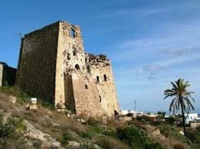
Emporio
Emporio, your current destination is the biggest village of Santorini and one of the five fortified medieval
settlements. The kasteli of Emporio, apart from its defensive character, was an important trade center. All sorts of merchandize were sold here. The market place was most likely also very dynamic production place. All in all, the name of the village is a reminder of the past: Greek: emporio translates to “market place”.
Due to its topographic location the kasteli of Emporio was surveying the southern part of the island. Its structure was not different from that of Pyrgos and Akrotiri, with a tangle of narrow alleyways and tightly packed dwellings. Kasteli of Emporio gave shelter to more than 80 families but, as all other kastelia, was inhabited mainly by noblemen.
The characteristic element of fortification still preserved in Emporio is the 15th century goulas, adjacent to the Kasteli. Goulades were massive tetragonal structures which played a
diverse role.
At time of peace they were used to store agricultural products, during piracy attacks they offered shelter and were also a point of defense. Both goulas and kasteli of Emporio are quite nwell preserved and strolling around there is really exciting adventure.
The picture of the village is completed by ruined windmills on the nearby located hill of Gavrilos. Due to the windy character of the island, windmills have been a permanent element of Satorini landscape since at least the 14th century. They were used to grind barley and fava-beans.
Later windmills had also baker’s oven at their lowest part. Windmills spread along the hill of Gavrilos are dated to
the 19th century.
To the north of Emporio is located a relatively flat hill with another broken windmill at the top. This hill, called Chalarovounia, is also an excavation site. On Chalarovounia there has been found pottery dated to the last period of
habitation on the island before the big eruption of the volcano in 17th BC.
Last but not least, by the entrance to Emporio is located a small church of Aghios Nikolaos Marmaritis. Originally
it was a Doric tomb dated from 3rd century BC, six ages later it was converted into a Christian monument dedicated to Saint Nicolas. It is built from grey marble, from which it took its name Marmaritis (Greek: marble).
With all these attractions and its approx. 3000 permanent residents Emporio still refuses to become tourist destination.
Strolling around:
The square in Emporio is a quite busy place. At the back of the square there is a statue dedicated to the locals who fell in the war. This is also a nice place where you can find a bench to sit among trees.
By the side of the square is kalderimi that leads up to kasteli. You be sure to spot it easily, there is signpost to the Traditional area and big mansion (currently it is a school) just behind it.
Kasteli is only 3 minutes away from there. Following this way you will pass next to the church of Evangelismos. Not even 30 years old, this edifice is at the top list of the biggest churches of the island. Around here you can meet a local farmer selling wild capers. By the end of kalderimi the right turn will lead you to the kasteli, while the left turn – to the goulas.
However, the best way to see the goulas close is by following the narrow path along the children’s playground (behind cash machine) before the main square. Do not miss the ruins
of hyposkafa (cave houses) on the right side of this way! Take the first turn left and then right and in 5-8 minutes you will get in front of the goulas. The last 10 m of the pathway is quite steep, stony and slippery, so take care. On the top of goulas was a church, still you can see fragments of its vaulted roof. The goulas was a multi-storey massive construction. It suffered from damages mostly due to the 1956 earthquake.
Just a hint: Show a respect to the sign stuck in front of goulas and keep off the ruins.
Some 50 m down from the goulas there is a church of Aghia Kyriaki. It was built between the 15th and 16th century and its architectonical prototype was Theotokaki, the 10th century church on top of the kasteli in Pyrgos.
From this point it is possible to walk around the goulas. Continue to go along the street that brought you to goulas so that in next 5 minutes you will be able to see it from above. Further on this street will also lead you to the kasteli.
Kasteli of Emporio is an amazing place, quite well preserved and despite the destructive earthquakes, neat and full of
charm.
Immediately after entering the kasteli you will get into a real tangle of extremely narrow streets and passages, with tightly packed colorful, small houses of irregular shapes. From the church of Agios Giorgos follow the street up to the northwest and go through a passage under an arch. It will lead you in front of Panagia Mesani, a church built in the 16th
century, with a sophisticated belltower. Panagia Mesani is located in the center of kasteli, because of this takes its name (Greek: mesa = in the middle). If you turn right in front
of Panagia Mesani and follow the passage you will get to the original entrance to the kastelli. In historical times this gate was the only way to get in. In front of the gate there is
a square. Small church just opposite to it is Aghia Theodosia. The big church down to the left is Aghios Spiridion. Next to the gate you will see ruined cave houses. The passage
behind it leads straight to the church of Aghios Georgios. Down to the east from Aghios Georgios is Metamorphosis of Sotiros, a 19th century church with a beautiful bell-tower.
Make sure your camera has enough memory because in this picturesque place you will keep
it very busy. The fact is also that kasteli is a real labyrinth of narrow passages. Do not worry; just remember that the main square of Emporio is somewhere down to the SE…
Option for tough hikers:
Approximately 500 m from the main square of Emporio along the main road towards Megalochori is located a little church of St. Nicolas Marmaritis. Half way to this church, on the crossroads there is a mini-church. Mini-churches are dedicated to victims of road accidents.
Roads on Santorini belong to the most dangerous, especially during summer, when traffic is really busy. Further on from this place you will encounter a ceramic workshop. Looking to the north is the round hill of Chalarovounia with its single windmill protruding from its the top.
Not even 100 m from the church of St. Nicolas Marmaritis, in the direction back to Emporio, the road is cut by a village street. Turn right (follow the sign to Escape Café) if you want to get on the hill of Gavrilos. According to the signpost you have approx. 1500 m to go, but you
will enjoy it. The street leads among vineyards and flowery meadows. Look at the vines with their characteristic circular shape (see: MEGALOCHORI to learn more about them). On the way you will have also opportunity to have a close look at the old windmills.
There are 8 windmills standing along the hill. At the very end of the hill there is a white little church, built just at the rim of a crag. This is Profitis Ilias o Chamilos (Low Prophet Elias) in
contrary to Profitis Ilias o Psilos (High Prophet Elias) overlooking it from a far distance. If you turn back you spot it on the top of the high mountain. In front of it, slightly
more to the W is Chalarovounia with its characteristic single windmill. This hill seems to be actually crowned by white houses of Pyrgos, emerging just behind. A long beach on the eastern side of the hill of Gavrilos is the famous black beach
of Perissa and Perivolos. Down by the hill you will see picturesquely terraced fields. Also the western side
of the hill offers a spectacular view.
The white village on the peninsula is called Akrotiri, while the small one closer to you is Vlychada. See the original landscape created by wind and sea erosion. It is outstanding!
At this point you may find a good idea to have a rest in the cafeteria mercifully set nearby…
Oia, one of the five medieval fortified settlements of Santorini. It was named Kastro tou Aghiou Nikolaou (Castle of St. Nicolas) after an early 16th century church dedicated
to the Saint. The Kasteli was located on the hardly accessible NW ridge of the Caldera, and dwellings within the Kasteli were mostly hysposkafa, cut in the steep rocks of the Caldera.
The settlement on old maps is also known as Pano Meria (the Upper Side). With the course of time the fortified settlement spread over to the west and east. In the oldest NW part was built a look-out tower (goulas).
After the 1956 earthquake Kastro tou Aghiou Nikolaou was severely damaged and currently only ruins of goulas are an evidence of its existence. Around there are crammed one on another cave houses, a part of the old fortification. At the very cliff, nearly hanged on the rocks, is the old church Zoodochou Pigi.
Next to it was the church of Panagia Platsani, hidden in a cave. According to a story, icon of Virgin Mary was found in Crete and brought to Oia. Originally it was placed in one of
the churches near goulas, but the icon in some unexplained way moved to the cave on the verge of the cliff. The locals believed that Virgin Mary wanted to look at distant Crete, from were she was brought and therefore they adopted the
cave for a church of Panagia Platsani.
However, after the 1956 earthquake the cave collapsed. A new church was built on the square of Oia and the icon
was moved there. The new church of Panagia Platsani became also the metropolis.
It is said that Oia was built by the captains and sailors. The peak of Oia’s development falls in the 18th-early
20th centuries. Oia had two harbors during the 19th-early 20th century: Armeni – where you can descend 286 steps and Ammoudi with its 214 steps. From here the merchandize was shipped mostly to Russia and Alexandria.
Most of nearly 80 churches in Oia are dated to years of its greatest marine prosperity. Most of the churches were raised by seamen who got rescued from a storm or by their families, waiting in agony for their return.
Yet in the 19th century the main street of Oia, which is running along the Caldera, had been paved with marble
flagstones, a sign of prosperity of the village. Since then this street is called Marmara. In the 18th century the piracy
raids were already a past, people had no more need to live within the hardly accessible fortifications. Frequent contacts with distant cultures found their reflection also in architecture.
On Santorini, and especially in Oia (mostly in its western part called Sideras), appeared a new category of houses. They were built according to well designed and thought-of plan, had therefore regular shapes and sophisticated ornaments.
The earliest ones were based on the Italian Renaissance. Later on also the neoclassical and eclectic styles appeared. These houses called archontika or mansions belonged to the wealthiest inhabitants of the island. No wonder that most of them were built in Oia, by captains of the ships. For this reason here they were called kapetanospitia (captain houses). Sailors were still dwelling in numerous caves dug in the slopes of the Caldera.
By the beginning of the 20th century Oia was densely populated. However the earthquake of 1956 caused severe
damages to the village, most of the cave houses and beautiful mansions collapsed.
By the end of the 20th century merely 1000 people were living in Oia and more or less this number remains until today.
You can take your own tour of history in Oia by visiting the Maritime Museum. It was created in 1951 and severely damaged during the earthquake five years later. However the owner, captain Antonis Dakoronias put all his efforts into restoring it.
The museum is located in a 19th century mansion.
Today’s Oia holds its post of the wealthiest settlement on Santorini.
Strolling around:
West from the bus terminal is Sideras focusing the finest examples of captain houses. Most of them are abandoned and partly ruined now but they are still the reminder about the wealth of their past owners. Look at the beautiful ornaments of anchors and frequently still readable initials
of the family names. From Sideras you get out towards Marmara, the main street elegantly covered with marble. It runs along the edge of the Caldera. The Caldera in Oia is densely built up with luxury hotels; however it is not difficult to spot old ruined cave houses in between.
The two relatively big churches with blue domes raised on the Caldera one by another are the churches of St. Spiridion and of Resurection. In their proximity there is a considerable number of other churches, therefore this part of the Caldera is called Monastiri.
Following Marmara to the west you will get to a district called Lotza where the city hall is located. If you are interested in marine history of Oia pay a visit to the nearby located
Maritime Museum, follow the signs to get there.
In Lotza is located goulas. You will find it easily on the rim of the Caldera, next to a stairway which leads down to Ammoudi. By the southernmost verge of the rock is the church of Zooodochos Pigi, once next to it was a cave church with the icon of Panagia Platsani. The neighborhood of goulas is currently the beloved place for watching sunsets. In summer though, you should be prepared for crowds of people, who massively gather all over with one scope – to take pictures of the
+
evening sun. At evening hours Oia is probably turning into one of the most densely populated cities of the world!
The southwestern borders of medieval fortifications reached as far as too windmills which stay there until today. They are called Garbinoi Myloi after garbis – the southwestern wind.
From goulas you can descend to Ammoudi, following 214 steps. The long zig-zag of stairways is called by the locals
karavolades. Descending to Ammoudi gives you an opportunity to have close look at the cliffs of Caldera. You will pass next to cave houses dug in the steep rock. On right
side down the slope is the old church of St. Nicolas,
built with red volcanic stones. However it is not the cliff that you can see from close now. The same way is frequently used by mules, which have also their physiological needs. So keep watching also your steps…
To Ammoudi leads also a regular road that is passing next to an old quarry of pumice. The small harbor of Ammoudi is the place where from you can hire a boat that will take you to
Thirassia. There is also a small beach with red sand here.
You can also get to the small beach of Armeni, which was the second harbor of Oia. You will find the stairways to Armeni at the eastern part of Marmara, some 150 m away from goulas. Armeni requires much more determination than Ammoudi, because - remember – the karavolades here count 286 steps….
By Marmara, on the way between Ammoudi and Armeni there is a vast square duly called “balcony of Oia”. On its back is located a new church of Panagia Platsani, built after the
earthquake. This is also the metropolis of Pano Meria. The famous icon was moved here together with the old templon. The two other templons on its sides were added later, after the new church was built.
24 locals recommend
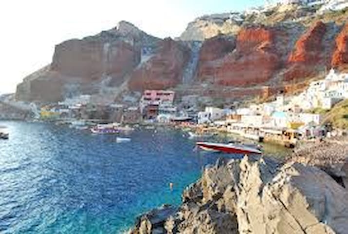
Oia Santorini
Oia, one of the five medieval fortified settlements of Santorini. It was named Kastro tou Aghiou Nikolaou (Castle of St. Nicolas) after an early 16th century church dedicated
to the Saint. The Kasteli was located on the hardly accessible NW ridge of the Caldera, and dwellings within the Kasteli were mostly hysposkafa, cut in the steep rocks of the Caldera.
The settlement on old maps is also known as Pano Meria (the Upper Side). With the course of time the fortified settlement spread over to the west and east. In the oldest NW part was built a look-out tower (goulas).
After the 1956 earthquake Kastro tou Aghiou Nikolaou was severely damaged and currently only ruins of goulas are an evidence of its existence. Around there are crammed one on another cave houses, a part of the old fortification. At the very cliff, nearly hanged on the rocks, is the old church Zoodochou Pigi.
Next to it was the church of Panagia Platsani, hidden in a cave. According to a story, icon of Virgin Mary was found in Crete and brought to Oia. Originally it was placed in one of
the churches near goulas, but the icon in some unexplained way moved to the cave on the verge of the cliff. The locals believed that Virgin Mary wanted to look at distant Crete, from were she was brought and therefore they adopted the
cave for a church of Panagia Platsani.
However, after the 1956 earthquake the cave collapsed. A new church was built on the square of Oia and the icon
was moved there. The new church of Panagia Platsani became also the metropolis.
It is said that Oia was built by the captains and sailors. The peak of Oia’s development falls in the 18th-early
20th centuries. Oia had two harbors during the 19th-early 20th century: Armeni – where you can descend 286 steps and Ammoudi with its 214 steps. From here the merchandize was shipped mostly to Russia and Alexandria.
Most of nearly 80 churches in Oia are dated to years of its greatest marine prosperity. Most of the churches were raised by seamen who got rescued from a storm or by their families, waiting in agony for their return.
Yet in the 19th century the main street of Oia, which is running along the Caldera, had been paved with marble
flagstones, a sign of prosperity of the village. Since then this street is called Marmara. In the 18th century the piracy
raids were already a past, people had no more need to live within the hardly accessible fortifications. Frequent contacts with distant cultures found their reflection also in architecture.
On Santorini, and especially in Oia (mostly in its western part called Sideras), appeared a new category of houses. They were built according to well designed and thought-of plan, had therefore regular shapes and sophisticated ornaments.
The earliest ones were based on the Italian Renaissance. Later on also the neoclassical and eclectic styles appeared. These houses called archontika or mansions belonged to the wealthiest inhabitants of the island. No wonder that most of them were built in Oia, by captains of the ships. For this reason here they were called kapetanospitia (captain houses). Sailors were still dwelling in numerous caves dug in the slopes of the Caldera.
By the beginning of the 20th century Oia was densely populated. However the earthquake of 1956 caused severe
damages to the village, most of the cave houses and beautiful mansions collapsed.
By the end of the 20th century merely 1000 people were living in Oia and more or less this number remains until today.
You can take your own tour of history in Oia by visiting the Maritime Museum. It was created in 1951 and severely damaged during the earthquake five years later. However the owner, captain Antonis Dakoronias put all his efforts into restoring it.
The museum is located in a 19th century mansion.
Today’s Oia holds its post of the wealthiest settlement on Santorini.
Strolling around:
West from the bus terminal is Sideras focusing the finest examples of captain houses. Most of them are abandoned and partly ruined now but they are still the reminder about the wealth of their past owners. Look at the beautiful ornaments of anchors and frequently still readable initials
of the family names. From Sideras you get out towards Marmara, the main street elegantly covered with marble. It runs along the edge of the Caldera. The Caldera in Oia is densely built up with luxury hotels; however it is not difficult to spot old ruined cave houses in between.
The two relatively big churches with blue domes raised on the Caldera one by another are the churches of St. Spiridion and of Resurection. In their proximity there is a considerable number of other churches, therefore this part of the Caldera is called Monastiri.
Following Marmara to the west you will get to a district called Lotza where the city hall is located. If you are interested in marine history of Oia pay a visit to the nearby located
Maritime Museum, follow the signs to get there.
In Lotza is located goulas. You will find it easily on the rim of the Caldera, next to a stairway which leads down to Ammoudi. By the southernmost verge of the rock is the church of Zooodochos Pigi, once next to it was a cave church with the icon of Panagia Platsani. The neighborhood of goulas is currently the beloved place for watching sunsets. In summer though, you should be prepared for crowds of people, who massively gather all over with one scope – to take pictures of the
+
evening sun. At evening hours Oia is probably turning into one of the most densely populated cities of the world!
The southwestern borders of medieval fortifications reached as far as too windmills which stay there until today. They are called Garbinoi Myloi after garbis – the southwestern wind.
From goulas you can descend to Ammoudi, following 214 steps. The long zig-zag of stairways is called by the locals
karavolades. Descending to Ammoudi gives you an opportunity to have close look at the cliffs of Caldera. You will pass next to cave houses dug in the steep rock. On right
side down the slope is the old church of St. Nicolas,
built with red volcanic stones. However it is not the cliff that you can see from close now. The same way is frequently used by mules, which have also their physiological needs. So keep watching also your steps…
To Ammoudi leads also a regular road that is passing next to an old quarry of pumice. The small harbor of Ammoudi is the place where from you can hire a boat that will take you to
Thirassia. There is also a small beach with red sand here.
You can also get to the small beach of Armeni, which was the second harbor of Oia. You will find the stairways to Armeni at the eastern part of Marmara, some 150 m away from goulas. Armeni requires much more determination than Ammoudi, because - remember – the karavolades here count 286 steps….
By Marmara, on the way between Ammoudi and Armeni there is a vast square duly called “balcony of Oia”. On its back is located a new church of Panagia Platsani, built after the
earthquake. This is also the metropolis of Pano Meria. The famous icon was moved here together with the old templon. The two other templons on its sides were added later, after the new church was built.
Beach
Monolithos is stretched along the airport. The beach of
Monolithos is a perfect place for families with children. The
beach is organized and the sea here is relatively shallow. You
will find here enough free space to relax on the black sand.
The landmark of the region is a grey rock with the church of St. John the Baptist on the top. The rock gave name to the village.
Greek: Mono-lithos translates to “single rock”.
Together with mountain of Mesa Vouno and Profitis Ilias, this is a nonvolcanic formation. So they stay in contrast to the rest of the island, which is covered with layers of volcanic ashes, gradually thickening with each of the 14 eruptions that took place within last 3500 years.
The first Santorini tomato factory was built 1925-26 in Monolithos. At the beginning of the 20th century, when worldwide interest to Santorini wine declined dramatically, farmers switched to growing tomatoes. Export of Santorini tomatoes soon became very profitable and tomato factories were needed, to ensure effective sale to the most
distant destinations.
By the mid 20th century there were 13 tomato factories on the island.
Currently only one is still operating in Monolithos.
Apart from the above attractions Monolithos is stretched along the sea shore, so what it has to offer is so beach, beach, beach….
Strolling around:
Monolithos has an organized black sandy beach that is
more quiet and relaxing than adjacent Kamari.
From the beach of Monolithos you can visit the church of St.
John the Baptist on the rock. It will take you no more than
10 minutes to walk there. The tomato factory is by the
square. If you like to have a walk, go along the beach to
the north to see sophisticated forms of eroded volcanic
rocks. You can find caves dug in there as well.
A walk to the south will take you to Gaia Winery, which is set in an old tomato factory. This one is though at fair distance, more than 3 km from the square.
13 locals recommend
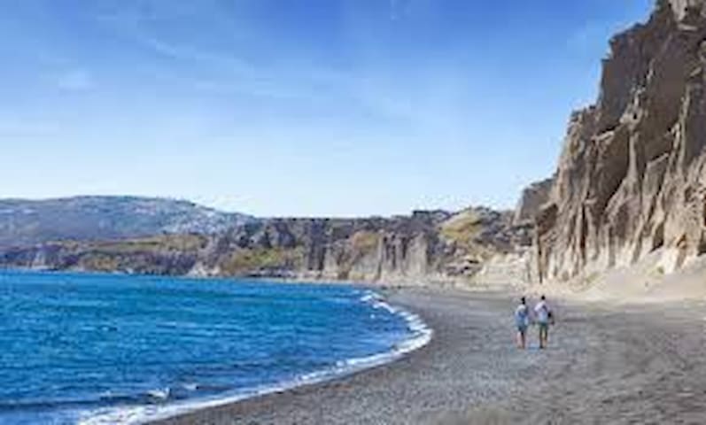
Monolithos Beach
Monolithos is stretched along the airport. The beach of
Monolithos is a perfect place for families with children. The
beach is organized and the sea here is relatively shallow. You
will find here enough free space to relax on the black sand.
The landmark of the region is a grey rock with the church of St. John the Baptist on the top. The rock gave name to the village.
Greek: Mono-lithos translates to “single rock”.
Together with mountain of Mesa Vouno and Profitis Ilias, this is a nonvolcanic formation. So they stay in contrast to the rest of the island, which is covered with layers of volcanic ashes, gradually thickening with each of the 14 eruptions that took place within last 3500 years.
The first Santorini tomato factory was built 1925-26 in Monolithos. At the beginning of the 20th century, when worldwide interest to Santorini wine declined dramatically, farmers switched to growing tomatoes. Export of Santorini tomatoes soon became very profitable and tomato factories were needed, to ensure effective sale to the most
distant destinations.
By the mid 20th century there were 13 tomato factories on the island.
Currently only one is still operating in Monolithos.
Apart from the above attractions Monolithos is stretched along the sea shore, so what it has to offer is so beach, beach, beach….
Strolling around:
Monolithos has an organized black sandy beach that is
more quiet and relaxing than adjacent Kamari.
From the beach of Monolithos you can visit the church of St.
John the Baptist on the rock. It will take you no more than
10 minutes to walk there. The tomato factory is by the
square. If you like to have a walk, go along the beach to
the north to see sophisticated forms of eroded volcanic
rocks. You can find caves dug in there as well.
A walk to the south will take you to Gaia Winery, which is set in an old tomato factory. This one is though at fair distance, more than 3 km from the square.
Picturesquely located where the sea meets the mountain, Kamari has become a focus of summer leisure. It is lively and bustling village, with the long, organized Black Beach.
But you make the mistake thinking that Kamari has nothing more to offer. The site where this modern village is located has its long, long history.
You can find Kamari on the northern site of Mesa Vouno. On top of this mountain at the end of the 19th century were discovered the ruins of a city, known as Ancient Thira. Also an ancient cemetery stretching to the west from Ancient Thira towards the mountain of Profitis Ilias was excavated there.
Ancient Thira is the first known settlement established after the catastrophic eruption of the volcano in 17th BC. For the next 500 years after this eruption the island remained uninhabited.
The first people that arrived to the abandoned island were presumably Spartans. They established their settlement on the top of Mesa Vouno 385 m above the sea level and named it after their leader – Thira. It was also the first ancient capital of the island which held control over the six other settlements that were soon established on the island. Needless to say that Ancient Thira left firm trace of its existence not only in the island’s administration, but also
in its…official name.
Excavations on the foot of Mesa Vouno, in the NW part of the village of Kamari had been initiated in 19th century and brought to light remainders of an ancient settlement and its
cemetery. History of this settlement, called Ancient Oia, goes back to the 8th BC. The best known in Kamari sign of its existence is so called “kamara” to which the village owes its
name. “Kamara” is a monumental arch, partly built and partly dug in the rock. Presumably in ancient times this place was custom where merchant ships were arriving to pay taxes. There is no doubt that Ancient Oia was the harbor of Ancient Thira.
In one of the caves of Mesa Vouno on side of Kamari, is a real rarity of this island – a natural spring of sweet water.
The spring is duly called the Fountain of Life (Zoodochos Pigi). At the entrance to the cave is a church by the same name. The church was built between years 1825-34. The spring is located 190 m above the sea level.
Worth paying attention is also the church of Panagia Mirtidiotissa by the entrance to the village.
After the 1956 earthquake army services built in Kamari rows
of small stables (Greek: stavli), small shelters for animals that
were held there until the farmer’s possessions were restored.
Now, more than 50 years after the earthquake, Kamari offers
everything that is needed to spend an unforgotten summer
on Santorini.
Strolling around:
The Black beach of Kamari is covered with pebbles. Water is
crystal-clear here and the beach-front is well organized and offers top-quality bathing. Scubadiving, wind-surfing, jet-ski is just some of the pleasures waiting for the most adventurous.
By the main road, at the entrance to Kamari is the church of Panagia Mirtidiotissa. If you follow the road up to the mountain you will find the route to Ancient Thira. From Kamari this is a quite comfortable way, also available for cars.
A walk to the top of Mesa Vouno takes approximately 40 minutes. Keep in mind that Ancient Thira is open for visits from 8:00 to 14.30, closed on Mondays (check online the time table). From the parking area at the top of the mountain to the entrance of excavations leads a trail that now and again is quite difficult, especially in hot summer days. There is a mini shop on the parking area where water and snacks are sold. If you have no water with you, it is good place and time to get some, because there will be no such possibility after you get to the excavation site.
The site is about 800 m long but not its entire area is available for sightseeing.
Just by the entrance to Ancient Thira you encounter the church of Aghios Stefanos which is the oldest church on this island. From this point to the ruins of the ancient city you will need 10-15 minutes up the hill. Whilst visiting the excavations have a look also down the mountain.
Kamari is stretching on its north side and Perissa on the south. On the return you can either descend back to Kamari (by bus or on foot), or walk down to Perissa. The trail requires sport shoes but is very picturesque. It takes about 20 minutes to go down to Perissa.
Also the descent on foot to Kamari takes less time than the way up, one more proof that everything is relative…
Near the street descending to Kamari you can find trail to Zoodochos Pigi (Lifegiving). The trail begins behind the second curve of the street counting from Ancient Thira. Much easier though is to find the trail from the Kamari village. It begins behind the Antinea Hotel. The spring is
in a shallow cave and you will have no problems finding it. From there you can climb up the stairs and go along the slope of Mesa Vouno; this trail without mistake will take you in the vicinity of Ancient Thira.
Remnants of Ancient Oia can be found on the southernmost part of Kamari beach, by the mountain. Ancient “kamara” is
carved on the foot of Mesa Vouno.
Following the earthquake of 1956 most of farmers from Mesa Gonia moved that time to Kamari to settle down there. Rows of shelters for their animals (so called “stavli”) were built
to temporarily keep them there, until new barns are fixed. The shelters are located near the football field.
Kamari has also two cinemas, one at the square and other some 200 m behind the village (open-air), on the road towards Fira. When you continue to walk along the main street you will approach Episkopi Gonias, Byzantine church of the 12th century. To get there follow
the signpost by the road or turn up behind the gas-station.
16 locals recommend
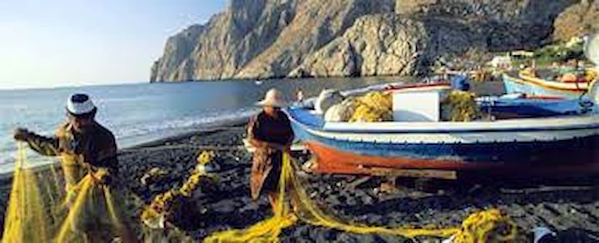
Kamari Beach
Picturesquely located where the sea meets the mountain, Kamari has become a focus of summer leisure. It is lively and bustling village, with the long, organized Black Beach.
But you make the mistake thinking that Kamari has nothing more to offer. The site where this modern village is located has its long, long history.
You can find Kamari on the northern site of Mesa Vouno. On top of this mountain at the end of the 19th century were discovered the ruins of a city, known as Ancient Thira. Also an ancient cemetery stretching to the west from Ancient Thira towards the mountain of Profitis Ilias was excavated there.
Ancient Thira is the first known settlement established after the catastrophic eruption of the volcano in 17th BC. For the next 500 years after this eruption the island remained uninhabited.
The first people that arrived to the abandoned island were presumably Spartans. They established their settlement on the top of Mesa Vouno 385 m above the sea level and named it after their leader – Thira. It was also the first ancient capital of the island which held control over the six other settlements that were soon established on the island. Needless to say that Ancient Thira left firm trace of its existence not only in the island’s administration, but also
in its…official name.
Excavations on the foot of Mesa Vouno, in the NW part of the village of Kamari had been initiated in 19th century and brought to light remainders of an ancient settlement and its
cemetery. History of this settlement, called Ancient Oia, goes back to the 8th BC. The best known in Kamari sign of its existence is so called “kamara” to which the village owes its
name. “Kamara” is a monumental arch, partly built and partly dug in the rock. Presumably in ancient times this place was custom where merchant ships were arriving to pay taxes. There is no doubt that Ancient Oia was the harbor of Ancient Thira.
In one of the caves of Mesa Vouno on side of Kamari, is a real rarity of this island – a natural spring of sweet water.
The spring is duly called the Fountain of Life (Zoodochos Pigi). At the entrance to the cave is a church by the same name. The church was built between years 1825-34. The spring is located 190 m above the sea level.
Worth paying attention is also the church of Panagia Mirtidiotissa by the entrance to the village.
After the 1956 earthquake army services built in Kamari rows
of small stables (Greek: stavli), small shelters for animals that
were held there until the farmer’s possessions were restored.
Now, more than 50 years after the earthquake, Kamari offers
everything that is needed to spend an unforgotten summer
on Santorini.
Strolling around:
The Black beach of Kamari is covered with pebbles. Water is
crystal-clear here and the beach-front is well organized and offers top-quality bathing. Scubadiving, wind-surfing, jet-ski is just some of the pleasures waiting for the most adventurous.
By the main road, at the entrance to Kamari is the church of Panagia Mirtidiotissa. If you follow the road up to the mountain you will find the route to Ancient Thira. From Kamari this is a quite comfortable way, also available for cars.
A walk to the top of Mesa Vouno takes approximately 40 minutes. Keep in mind that Ancient Thira is open for visits from 8:00 to 14.30, closed on Mondays (check online the time table). From the parking area at the top of the mountain to the entrance of excavations leads a trail that now and again is quite difficult, especially in hot summer days. There is a mini shop on the parking area where water and snacks are sold. If you have no water with you, it is good place and time to get some, because there will be no such possibility after you get to the excavation site.
The site is about 800 m long but not its entire area is available for sightseeing.
Just by the entrance to Ancient Thira you encounter the church of Aghios Stefanos which is the oldest church on this island. From this point to the ruins of the ancient city you will need 10-15 minutes up the hill. Whilst visiting the excavations have a look also down the mountain.
Kamari is stretching on its north side and Perissa on the south. On the return you can either descend back to Kamari (by bus or on foot), or walk down to Perissa. The trail requires sport shoes but is very picturesque. It takes about 20 minutes to go down to Perissa.
Also the descent on foot to Kamari takes less time than the way up, one more proof that everything is relative…
Near the street descending to Kamari you can find trail to Zoodochos Pigi (Lifegiving). The trail begins behind the second curve of the street counting from Ancient Thira. Much easier though is to find the trail from the Kamari village. It begins behind the Antinea Hotel. The spring is
in a shallow cave and you will have no problems finding it. From there you can climb up the stairs and go along the slope of Mesa Vouno; this trail without mistake will take you in the vicinity of Ancient Thira.
Remnants of Ancient Oia can be found on the southernmost part of Kamari beach, by the mountain. Ancient “kamara” is
carved on the foot of Mesa Vouno.
Following the earthquake of 1956 most of farmers from Mesa Gonia moved that time to Kamari to settle down there. Rows of shelters for their animals (so called “stavli”) were built
to temporarily keep them there, until new barns are fixed. The shelters are located near the football field.
Kamari has also two cinemas, one at the square and other some 200 m behind the village (open-air), on the road towards Fira. When you continue to walk along the main street you will approach Episkopi Gonias, Byzantine church of the 12th century. To get there follow
the signpost by the road or turn up behind the gas-station.
The south-east coast of Santorini, located on the foot of Mesa Vouno is of special interest to all who love leisure at the seaside. Approximately 4 km of organized black sandy beach remains to their disposal. The sea is clear and the bottom has an interesting, volcanic form - shallow and slippery by the shore, where are prowling many Mediterranean fishes, suddenly drops into dark depth of the sea. The summer adventure begins in Perissa!
Excavations conducted in the 19th century indicated that Perissa was built on the site of the ancient city of Eleusina. At times of Hellenistic rule on this island (4th to 2nd centuries BC) the port of Eleusina was located at cape Exomitis (south from Perissa). The ancient settlement, according to information provided by archeological research, was abandoned around 7th century AD.
In Perissa is located the church of Holy Cross (Timiou Stavrou) which is the biggest church of the island. Its five blue domes are visible from the public road leading to Perissa. The church was built in the 19th century. Originally its interior was covered all over with beautiful wall-paintings. Most of them did not survive the 1956 earthquake. In Perissa there was also excavated an old Christian basilica of Aghia Irini (6th century), the island’s patron saint.
Santa (Aghia) Irini died here on exhale in the 4th century AD. They were Crusaders who at the beginning of the 13th century started calling the island after its patron. Thus Thera became Santorini.
Perissa underwent its rapid development within the past 30 years and is a good example of “touristic metamorphosis”. Until mid-seventieth Santorini was a quiet, unknown island lost somewhere in the Cyclades. Perissa was a green, almost deserted land. A couple of houses scattered here and there and the church of Holy Cross were the only signs of life here. From 1970 the significance of Santorini as a tourist destination increased dramatically. To accommodate the constantly increasing influx of tourists, new hotels have sprung up like mushrooms after the rain.
Putative economical profits offered by new industry attracted also locals, and soon number of permanent residents doubled.
Today’s Perissa is a well known summer resort, offering sandy black beach, summer sports, a bunch of souvenir shops, bakeries and mini markets scattered all along the village. The blue domes of the church of Holly Cross are not any more alone. They sink in the sea of white houses and hotels.
Perissa is a lively place during summer. The square of Perissa is the focus for main attractions of the village apart from the beach: The church of Holy Cross, Basilica of Aghia Irini, the
Museum of Minerals and Fossils and it is also a good starting point to explore Ancient Thira on the top of Mesa Vouno.
Strolling around:
The black, sandy beach of Perissa is a temptation in all its length. The beach is equipped in every amenity you need to spend unforgotten and relaxing day. You may have a problem to choose among numerous lively beach bars. The general rule is that if you order something in a beach bar, you can have an umbrella at your disposal all day long without any additional charge. Otherwise you may be asked to pay around 7 Euro per umbrella. If you are looking for a quieter place, without umbrellas and beach bars in the nearest proximity, there is a chance you will find it near the
mountain. This part of the beach is called by the locals Kolata. If it is not satisfying, you will have to undertake a 3 km walk along the beach to Perivolos.
On the beach are operating two diving centers, you will find also a water park nearby. Scubadiving, water ski, parachuting, windsurfing, jet-ski are at your disposal on the beach. In Perissa you can also try horse-riding.
Have also a stroll to the square of Perissa. Here you will find the big church of Holy Cross.
Some 50 m behind the church, at the foot of Mesa Vouno, are the ruins of Basilica of Aghia Irini. While at the square, step by to the small Museum of Minerals and Fossils, next to the church of the Holy Cross. On exhibition are fossils found on Santorini, which are estimated to be from 50 thousand to 1.5 billion years old! The museum is open from 10:00 to 14:00
everyday (ask before).
Option for tough hikers: From the square leads a street towards the mountain. If you follow it for the next 200 m you will get to the signpost for Ancient Thira. You can venture a walk up there. The footpath from Perissa is quite steep. During hot summer days it may be quite exhausting, especially if you are not used to mountaineering. You need about 40 minutes to get to the top, and because the excavation area is closed after 14.30, you must start before
noon.
At the entrance to excavations there is a church of Aghios Stefanos, the oldest church on Santorini, dated to the 5th century. From here there is another 10-15 minutes walk to get up to the ancient city. It may seem difficult, but consider
that they were Spartans who founded this settlement!
About one third of the way to Ancient Thira or just 10 minutes away from the foot of the mountain where you have
started climbing it up, there is another footway stretching to the east. This leads to the church of Panagia Katefiani.
The church is built on the steep slope of Mesa Vouno and is visible from a distance as a white spot in the middle of the mountain. Behind the church are caves. In medieval times this place offered refuge to the islanders during pirate attacks. It was also a refuge during so called “time of Evil” or in other words
- terrible eruption of the volcano Koloumbo in 1650
56 locals recommend
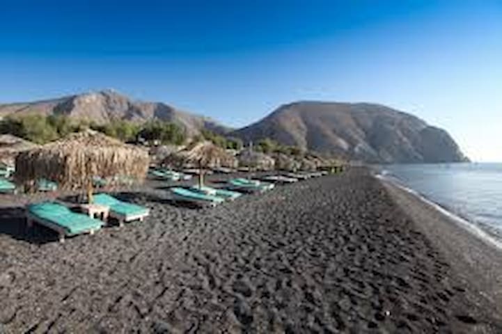
Perissa
The south-east coast of Santorini, located on the foot of Mesa Vouno is of special interest to all who love leisure at the seaside. Approximately 4 km of organized black sandy beach remains to their disposal. The sea is clear and the bottom has an interesting, volcanic form - shallow and slippery by the shore, where are prowling many Mediterranean fishes, suddenly drops into dark depth of the sea. The summer adventure begins in Perissa!
Excavations conducted in the 19th century indicated that Perissa was built on the site of the ancient city of Eleusina. At times of Hellenistic rule on this island (4th to 2nd centuries BC) the port of Eleusina was located at cape Exomitis (south from Perissa). The ancient settlement, according to information provided by archeological research, was abandoned around 7th century AD.
In Perissa is located the church of Holy Cross (Timiou Stavrou) which is the biggest church of the island. Its five blue domes are visible from the public road leading to Perissa. The church was built in the 19th century. Originally its interior was covered all over with beautiful wall-paintings. Most of them did not survive the 1956 earthquake. In Perissa there was also excavated an old Christian basilica of Aghia Irini (6th century), the island’s patron saint.
Santa (Aghia) Irini died here on exhale in the 4th century AD. They were Crusaders who at the beginning of the 13th century started calling the island after its patron. Thus Thera became Santorini.
Perissa underwent its rapid development within the past 30 years and is a good example of “touristic metamorphosis”. Until mid-seventieth Santorini was a quiet, unknown island lost somewhere in the Cyclades. Perissa was a green, almost deserted land. A couple of houses scattered here and there and the church of Holy Cross were the only signs of life here. From 1970 the significance of Santorini as a tourist destination increased dramatically. To accommodate the constantly increasing influx of tourists, new hotels have sprung up like mushrooms after the rain.
Putative economical profits offered by new industry attracted also locals, and soon number of permanent residents doubled.
Today’s Perissa is a well known summer resort, offering sandy black beach, summer sports, a bunch of souvenir shops, bakeries and mini markets scattered all along the village. The blue domes of the church of Holly Cross are not any more alone. They sink in the sea of white houses and hotels.
Perissa is a lively place during summer. The square of Perissa is the focus for main attractions of the village apart from the beach: The church of Holy Cross, Basilica of Aghia Irini, the
Museum of Minerals and Fossils and it is also a good starting point to explore Ancient Thira on the top of Mesa Vouno.
Strolling around:
The black, sandy beach of Perissa is a temptation in all its length. The beach is equipped in every amenity you need to spend unforgotten and relaxing day. You may have a problem to choose among numerous lively beach bars. The general rule is that if you order something in a beach bar, you can have an umbrella at your disposal all day long without any additional charge. Otherwise you may be asked to pay around 7 Euro per umbrella. If you are looking for a quieter place, without umbrellas and beach bars in the nearest proximity, there is a chance you will find it near the
mountain. This part of the beach is called by the locals Kolata. If it is not satisfying, you will have to undertake a 3 km walk along the beach to Perivolos.
On the beach are operating two diving centers, you will find also a water park nearby. Scubadiving, water ski, parachuting, windsurfing, jet-ski are at your disposal on the beach. In Perissa you can also try horse-riding.
Have also a stroll to the square of Perissa. Here you will find the big church of Holy Cross.
Some 50 m behind the church, at the foot of Mesa Vouno, are the ruins of Basilica of Aghia Irini. While at the square, step by to the small Museum of Minerals and Fossils, next to the church of the Holy Cross. On exhibition are fossils found on Santorini, which are estimated to be from 50 thousand to 1.5 billion years old! The museum is open from 10:00 to 14:00
everyday (ask before).
Option for tough hikers: From the square leads a street towards the mountain. If you follow it for the next 200 m you will get to the signpost for Ancient Thira. You can venture a walk up there. The footpath from Perissa is quite steep. During hot summer days it may be quite exhausting, especially if you are not used to mountaineering. You need about 40 minutes to get to the top, and because the excavation area is closed after 14.30, you must start before
noon.
At the entrance to excavations there is a church of Aghios Stefanos, the oldest church on Santorini, dated to the 5th century. From here there is another 10-15 minutes walk to get up to the ancient city. It may seem difficult, but consider
that they were Spartans who founded this settlement!
About one third of the way to Ancient Thira or just 10 minutes away from the foot of the mountain where you have
started climbing it up, there is another footway stretching to the east. This leads to the church of Panagia Katefiani.
The church is built on the steep slope of Mesa Vouno and is visible from a distance as a white spot in the middle of the mountain. Behind the church are caves. In medieval times this place offered refuge to the islanders during pirate attacks. It was also a refuge during so called “time of Evil” or in other words
- terrible eruption of the volcano Koloumbo in 1650
Perivolos is an extension of black sandy beach that begins in Perissa. Like Perissa, the beach is organized, not so crowded though. Along the beach you will find a variety of shops, mostly with beach items, beach bars and taverns. It offers also a wide range of water sports and beach volleyball. The southernmost part of Perivolos beach is called Agios Giorgos.
This is the most remote part of black beach, completely wild and quiet. The ancient port of Eleusina links Perivolos with Vlychada.
Strolling around:
If you spend your vacation on Santorini at the beginning of the season, there is good chance that from a short walk along the beach you will return with hand-fulls of colorful scallops.
Later on it will be much easier to collect pumice stones…
By the southern end of Perivolos you will find an old tomato factory. It is easy to distinguish because of its long chimney. From the 19th till mid 20th century there were 13 such factories operating on Santorini. They were producing world-wide renowned tomato pasta from small Santorini tomatoes.
Behind the factory a road leads in land. If you follow it for the next 2 km you will get to Emporio.
On its slopes here and there you will see carved arches. These are remnants of ancient port of Eleusina, founded by Ptolemies (4-2 century BC). Follow the footway along the mountain. By the end of this trail is an ancient tomb which you can see close.
The footway is about 1 km long and leads to Vlychada, so that you can go to the beach and chill down in the crystal clear sea waters of Vlychada.
10 locals recommend
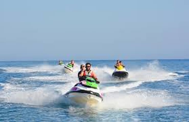
Perívolos
Perivolos is an extension of black sandy beach that begins in Perissa. Like Perissa, the beach is organized, not so crowded though. Along the beach you will find a variety of shops, mostly with beach items, beach bars and taverns. It offers also a wide range of water sports and beach volleyball. The southernmost part of Perivolos beach is called Agios Giorgos.
This is the most remote part of black beach, completely wild and quiet. The ancient port of Eleusina links Perivolos with Vlychada.
Strolling around:
If you spend your vacation on Santorini at the beginning of the season, there is good chance that from a short walk along the beach you will return with hand-fulls of colorful scallops.
Later on it will be much easier to collect pumice stones…
By the southern end of Perivolos you will find an old tomato factory. It is easy to distinguish because of its long chimney. From the 19th till mid 20th century there were 13 such factories operating on Santorini. They were producing world-wide renowned tomato pasta from small Santorini tomatoes.
Behind the factory a road leads in land. If you follow it for the next 2 km you will get to Emporio.
On its slopes here and there you will see carved arches. These are remnants of ancient port of Eleusina, founded by Ptolemies (4-2 century BC). Follow the footway along the mountain. By the end of this trail is an ancient tomb which you can see close.
The footway is about 1 km long and leads to Vlychada, so that you can go to the beach and chill down in the crystal clear sea waters of Vlychada.
Vlychada is a small village and its inhabitants are mainly fishermen. Black sandy beach of Vlychada is a SW extension of Perivolos, no more than 2 km away from it.
The pumice dunes fantastically sculptured by the wind are unusually picturesque. The beach is quiet but remains
in proximity of Limanaki – the port of Vlychada, full of small boats floating one by another.
The attraction of the spot is the old tomato factory. At the beginning of the 20th century such tomato factories played significant role in the island’s industry. “Thera style tomato pasta” was well recognized and desired worldwide due to the unique taste of Santorini’s tomatoes.
Santorini tomatoes (called also baby tomatoes or tomatakia) have an unusual sweet taste; this is due to the lack of water during their vegetation. At the beginning of the 20th century their cultivation was more profitable than the production of wines!
In Vlychada you will also find a picturesque windmill overlooking the Limanaki.
Vlychada’s is located at the southernmost cap of Santorini, called Exomitis. In ancient times Ptolemies set their naval base, Eleusina, in this area.
Strolling around:
Vlychada has to offer a picturesque black beach, at some distance from the Limanaki.
Over there you can hire a boat that will take you to the red and white beaches of Santorini, which are located more to the west from Vlychada
If you want to have a break from the beach, take a walk
along the street next to the tomato factory. The street
up from the factory is about 1.5 km long and leads to
the main road connecting Megalochori with Emporio. It
is really scenic road.
Some people call it lunar landscape. It makes an impression and there are numerous hyposkafa (caves) hidden in the rocks. The street runs along Hill of Gavrilos (on the right side)
and before it ends you will be able to count if there are still 8 old windmills standing there…
30 locals recommend
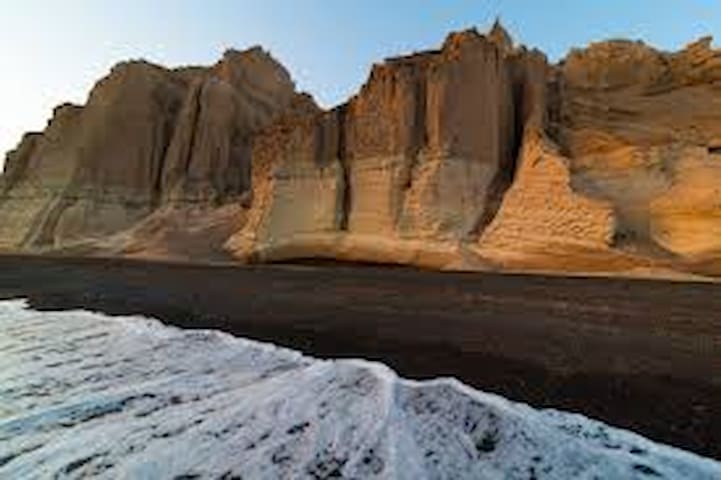
Paralia Vlichada
Vlychada is a small village and its inhabitants are mainly fishermen. Black sandy beach of Vlychada is a SW extension of Perivolos, no more than 2 km away from it.
The pumice dunes fantastically sculptured by the wind are unusually picturesque. The beach is quiet but remains
in proximity of Limanaki – the port of Vlychada, full of small boats floating one by another.
The attraction of the spot is the old tomato factory. At the beginning of the 20th century such tomato factories played significant role in the island’s industry. “Thera style tomato pasta” was well recognized and desired worldwide due to the unique taste of Santorini’s tomatoes.
Santorini tomatoes (called also baby tomatoes or tomatakia) have an unusual sweet taste; this is due to the lack of water during their vegetation. At the beginning of the 20th century their cultivation was more profitable than the production of wines!
In Vlychada you will also find a picturesque windmill overlooking the Limanaki.
Vlychada’s is located at the southernmost cap of Santorini, called Exomitis. In ancient times Ptolemies set their naval base, Eleusina, in this area.
Strolling around:
Vlychada has to offer a picturesque black beach, at some distance from the Limanaki.
Over there you can hire a boat that will take you to the red and white beaches of Santorini, which are located more to the west from Vlychada
If you want to have a break from the beach, take a walk
along the street next to the tomato factory. The street
up from the factory is about 1.5 km long and leads to
the main road connecting Megalochori with Emporio. It
is really scenic road.
Some people call it lunar landscape. It makes an impression and there are numerous hyposkafa (caves) hidden in the rocks. The street runs along Hill of Gavrilos (on the right side)
and before it ends you will be able to count if there are still 8 old windmills standing there…
Αξιοθέατα
Finikia is one of Oia’s districts. It is the first settlement before Oia village which you encounter arriving from Fira.
Finikia is located in a gorge; therefore most of the dwellings there are caves. Surprisingly, Finikia did not suffer very badly after the 1956 earthquake, so the village remains a lively picture of the past. As Oia is the village of seamen, Finikia is the village of farmers. The fields around Finikia are planted mainly with vines.
Strolling around:
Finikia is only 15 minutes away (walking distance) from Oia and it is one of those places that complete the picture of Santorini. The village is located down the main road, where the land forms natural ravine. The houses are built tightly one by another. To use more efficiently the limited space, in the wall of the ravine are dug the cave houses (hyposkafa). The streets are very narrow, with many steps, usually paved; some stretches are covered with concrete.
The east entrance to Finikia from the main road Fira-Oia is marked by signpost “Traditional Settlement”. If you walk to Finikia village from Oia, you can get there by the west entrance. You will have to pass along newer part of the village with houses representing typical contemporary
architecture. At the crossroads continue straight on to the east and you will soon get into a tangle of narrow stairways along which charming farm houses and old caves are densely located.
This is the traditional settlement. The highlight of Finikia is the church of Saint Matrona. Once the church used to be
salmon-colored, now the color slightly faded. Next to it is growing a slender palm tree.
To the right from this church is another one, dated to end of the 19th century. This is the church of Ypapanti, yellowcolored.
The stroll in Finikia does not require more than 20 minutes, because the settlement is really small, however you may need some more time to get out of this maze. The tavern
“To Krinaki”, near the exit, is waiting for exhausted guests…
Finish your visit to Finikia by turning left at the crossroads and getting up to the main road Fira-Oia (S). The village up
here is Perivolas, the gate to Oia. Almost immediately across the street you encounter the picturesque church of Aghios Vasilis. Keep walking towards Oia, do not miss the sign to
Desalination Plant which supplies the houses in Oia with drinkable water, therefore it is a pride of the Community.
Further on, on the left side of the street is the big church of Aghios Georgios. Until 1956 this church was the metropolis of Pano Meria.
After the 1956 earthquake army services build houses to accommodate the villagers who lost their own possessions. These houses are located on the right side of the street along Perivolas.
On the left side you can admire the Caldera.
11 locals recommend
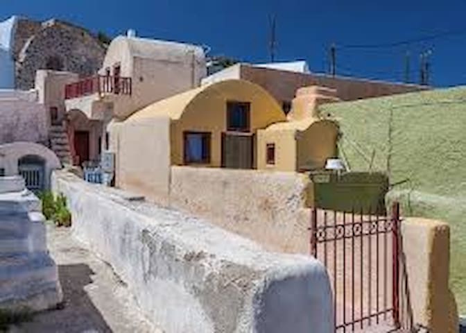
Finikia
Finikia is one of Oia’s districts. It is the first settlement before Oia village which you encounter arriving from Fira.
Finikia is located in a gorge; therefore most of the dwellings there are caves. Surprisingly, Finikia did not suffer very badly after the 1956 earthquake, so the village remains a lively picture of the past. As Oia is the village of seamen, Finikia is the village of farmers. The fields around Finikia are planted mainly with vines.
Strolling around:
Finikia is only 15 minutes away (walking distance) from Oia and it is one of those places that complete the picture of Santorini. The village is located down the main road, where the land forms natural ravine. The houses are built tightly one by another. To use more efficiently the limited space, in the wall of the ravine are dug the cave houses (hyposkafa). The streets are very narrow, with many steps, usually paved; some stretches are covered with concrete.
The east entrance to Finikia from the main road Fira-Oia is marked by signpost “Traditional Settlement”. If you walk to Finikia village from Oia, you can get there by the west entrance. You will have to pass along newer part of the village with houses representing typical contemporary
architecture. At the crossroads continue straight on to the east and you will soon get into a tangle of narrow stairways along which charming farm houses and old caves are densely located.
This is the traditional settlement. The highlight of Finikia is the church of Saint Matrona. Once the church used to be
salmon-colored, now the color slightly faded. Next to it is growing a slender palm tree.
To the right from this church is another one, dated to end of the 19th century. This is the church of Ypapanti, yellowcolored.
The stroll in Finikia does not require more than 20 minutes, because the settlement is really small, however you may need some more time to get out of this maze. The tavern
“To Krinaki”, near the exit, is waiting for exhausted guests…
Finish your visit to Finikia by turning left at the crossroads and getting up to the main road Fira-Oia (S). The village up
here is Perivolas, the gate to Oia. Almost immediately across the street you encounter the picturesque church of Aghios Vasilis. Keep walking towards Oia, do not miss the sign to
Desalination Plant which supplies the houses in Oia with drinkable water, therefore it is a pride of the Community.
Further on, on the left side of the street is the big church of Aghios Georgios. Until 1956 this church was the metropolis of Pano Meria.
After the 1956 earthquake army services build houses to accommodate the villagers who lost their own possessions. These houses are located on the right side of the street along Perivolas.
On the left side you can admire the Caldera.
The oldest Byzantine church of the island, Panagia Episkopi (built in 1115), is the pride of the locals.
It was built on the ruins of a 6th century church.
Marble pieces from the ruined church were
used to build the new one. Stones from Ancient Thira were also used to build the church
of Panagia Episkopi. Originally it was the seat of the Orthodox Bishop. Following the 4th
crusade the church it passed into the hands of the Catholics (early 13th century). When the Turks conquered Santorini in 1537, Panagia Episkopi returned to the Orthodox. The church is worth visiting not only because of its historical and architectural value, but also because of its
picturesque location. It is approximately 10 minutes walking distance to the south from Mesa
Gonia. Despite the stormy past: a disastrous fire in 1915, the earthquake in 1956 and theft of
most precious icons in 1982, the church is still one of the most important monuments of the
island. The one surviving icon from the Byzantine collection, Panagia Glikofilousa, is still in the church’s sanctuary. The church is one of the few of the island that are open for visiting.
Remember: Taking photographs with flash is forbidden inside the church!
The church is the first one on Santorini built in Greek-cross
style, with a central dome. You enter it by the western entrance. The first chamber is narthex. From here you pass to the nave. You are facing the impressing icon-screen (templon). It is an example of keromasticha - marble combined with wax decoration. The icons you see were brought to the church after the old ones had been stolen
about 30 years ago. The only one remaining after the robbery can be seen on a side of the
nave, covered with glass and under precise humidity control. Some of the marble pieces that were rescued from the previous church are: the central columns, the northern entrance and the architraves.
The church interior was decorated with frescoes. Unfortunately, humidity more than the time,
caused heavy damages to them.
While being on the courtyard of the church devote some time to enjoy the nice view of Kamari
and Monolithos, as well as the gorgeous mountain of Prophet Elias to the southwest.
On the back of the church is growing a carob tree, the fruits of which are considered a substitute
of chocolate, popularly used as donkey food but also to treat diabetes.
At the parking area, there is a small sweet-water spring. Springs of sweet water are very scant
in Santorini. Do not be mislead - this one collects rain water...
No more than 80 m down the street towards Mesa Gonia there is a white church located within
a small graveyard, and one more spring of rain water nearby. Here you will find a bench where
you can sit and contemplate the surroundings…
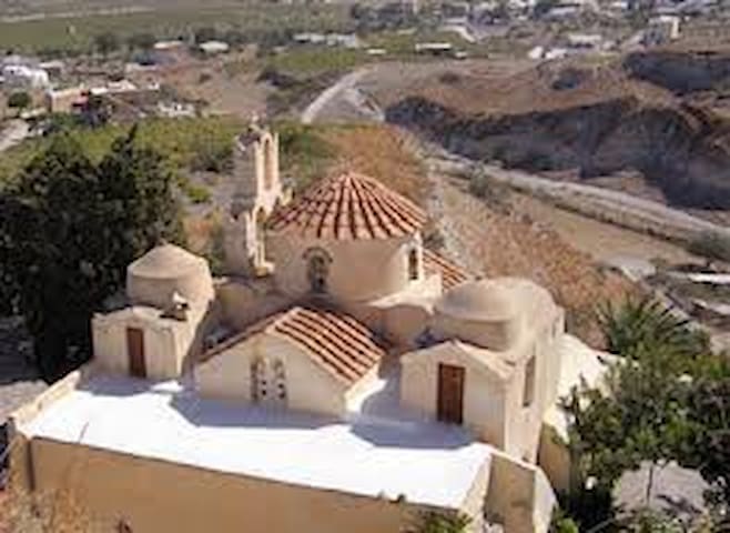
Panagia Episkopi
The oldest Byzantine church of the island, Panagia Episkopi (built in 1115), is the pride of the locals.
It was built on the ruins of a 6th century church.
Marble pieces from the ruined church were
used to build the new one. Stones from Ancient Thira were also used to build the church
of Panagia Episkopi. Originally it was the seat of the Orthodox Bishop. Following the 4th
crusade the church it passed into the hands of the Catholics (early 13th century). When the Turks conquered Santorini in 1537, Panagia Episkopi returned to the Orthodox. The church is worth visiting not only because of its historical and architectural value, but also because of its
picturesque location. It is approximately 10 minutes walking distance to the south from Mesa
Gonia. Despite the stormy past: a disastrous fire in 1915, the earthquake in 1956 and theft of
most precious icons in 1982, the church is still one of the most important monuments of the
island. The one surviving icon from the Byzantine collection, Panagia Glikofilousa, is still in the church’s sanctuary. The church is one of the few of the island that are open for visiting.
Remember: Taking photographs with flash is forbidden inside the church!
The church is the first one on Santorini built in Greek-cross
style, with a central dome. You enter it by the western entrance. The first chamber is narthex. From here you pass to the nave. You are facing the impressing icon-screen (templon). It is an example of keromasticha - marble combined with wax decoration. The icons you see were brought to the church after the old ones had been stolen
about 30 years ago. The only one remaining after the robbery can be seen on a side of the
nave, covered with glass and under precise humidity control. Some of the marble pieces that were rescued from the previous church are: the central columns, the northern entrance and the architraves.
The church interior was decorated with frescoes. Unfortunately, humidity more than the time,
caused heavy damages to them.
While being on the courtyard of the church devote some time to enjoy the nice view of Kamari
and Monolithos, as well as the gorgeous mountain of Prophet Elias to the southwest.
On the back of the church is growing a carob tree, the fruits of which are considered a substitute
of chocolate, popularly used as donkey food but also to treat diabetes.
At the parking area, there is a small sweet-water spring. Springs of sweet water are very scant
in Santorini. Do not be mislead - this one collects rain water...
No more than 80 m down the street towards Mesa Gonia there is a white church located within
a small graveyard, and one more spring of rain water nearby. Here you will find a bench where
you can sit and contemplate the surroundings…